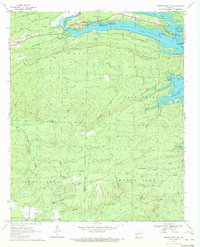
1970 Map of Center Point NE
USGS Topo · Published 1972About this map
Lake Greeson dominates the northeastern landscape of this 1970s survey, its waters reaching into the hills via Self Creek and Rock Creek. Along these banks, the Daisy State Park and several public use areas like Arrowhead Point reflect the mid-century development of the region's recreational infrastructure. In the west, the settlement of Newhope serves as a local hub near Eden Landmark Ch and the Shiloh Cem. The terrain is defined by significant ridges such as White Mountain, which features a prominent Lookout Tower, and the winding path of the Little Missouri River. The transition from upland timber to the river valley is marked by small-scale resource extraction, indicated by various Gravel Pits and a Shale Pit, alongside local landmarks like Wildcat Bluff and Sour Spring.
Find a feature on this map
47 named features on this map. Tap any name to fly to it.
Don’t see what you’re looking for? This feature index may not catch every label — zoom into the map to look around manually.
Map Details
Editions of this 1970 Center Point NE Map
This is the sole edition of this map. No revisions or reprints were ever made.
Other maps of this area

1906 · Caddo Gap
USGS Topo · 1:125,000

1936 · Athens
USGS Topo · 1:48,000

1936 · Glenwood
USGS Topo · 1:48,000

1942 · Glenwood
USGS Topo · 1:62,500

1942 · Athens
USGS Topo · 1:62,500

1949 · Glenwood
USGS Topo · 1:62,500

1955 · Little Rock
USGS Topo · 1:250,000

1956 · Little Rock
USGS Topo · 1:250,000

1960 · Little Rock
USGS Topo · 1:250,000

1964 · Little Rock
USGS Topo · 1:250,000