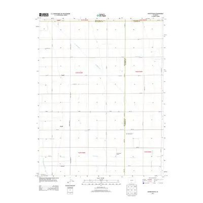
2013 Map of Center South
USGS Topo · Published 2013About this map
Agricultural precision and water management define this landscape south of Center in the San Luis Valley. The map reveals a strict orthogonal grid of roads and ditches, characteristic of the region's high-desert irrigation history. Key waterways like the Hiline Lateral, Rio Grande Drain, and Raney Ditch slice diagonally across the section lines, highlighting the engineering required to support the area's farming economy. Small, named locales such as Ansel, Dunul, and Vastine punctuate the grid, serving as reference points for local history and land ownership. The presence of Soldiers Home Rd and the Ditch Riders Rd provides insight into the community's civic and operational layout. This survey also records local aviation facilities, including Van Treese Airport and Mc Cullough Airport, which sit among the expansive fields near Prairie Ditch.
Find a feature on this map
47 named features on this map. Tap any name to fly to it.
Don’t see what you’re looking for? This feature index may not catch every label — zoom into the map to look around manually.
Map Details
Editions of this 2013 Center South Map
This is the sole edition of this map. No revisions or reprints were ever made.
Other maps of this area

1915 · Del Norte
USGS Topo · 1:125,000

1917 · Del Norte
USGS Topo · 1:125,000

1945 · Durango
USGS Topo · 1:250,000

1953 · Durango
USGS Topo · 1:250,000

1954 · Durango
USGS Topo · 1:250,000

1954 · Trinidad
USGS Topo · 1:250,000

1955 · Trinidad
USGS Topo · 1:250,000

1958 · Trinidad
USGS Topo · 1:250,000

1959 · Trinidad
USGS Topo · 1:250,000

1961 · Durango
USGS Topo · 1:250,000