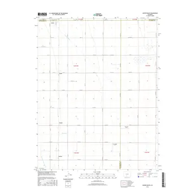
2016 Map of Center South
USGS Topo · Published 2016About this map
The town of Center anchors this high-plains landscape, where the agricultural grid meets a complex network of water management features designed to sustain the arid San Luis Valley. This survey reveals a meticulously partitioned terrain defined by the intersections of three counties — Saguache, Rio Grande, and Alamosa. The reliance on irrigation is evident through the extensive system of waterways, including the Rio Grande Drain and several named ditches like the Raney Ditch and Prairie Ditch. These man-made channels dictate the placement of local settlements and infrastructure across the valley floor. Small hamlets and rail-related stops such as Ansel, Dunul, and Vastine appear along the section lines, while the Van Treese Airport and Mc Cullough Airport serve as modern landmarks in this rural expanse. The map illustrates how transportation routes like Twelvemile Rd and S Broadway follow the rigid township and range system.
Find a feature on this map
52 named features on this map. Tap any name to fly to it.
Don’t see what you’re looking for? This feature index may not catch every label — zoom into the map to look around manually.
Map Details
Editions of this 2016 Center South Map
This is the sole edition of this map. No revisions or reprints were ever made.
Other maps of this area

1915 · Del Norte
USGS Topo · 1:125,000

1917 · Del Norte
USGS Topo · 1:125,000

1945 · Durango
USGS Topo · 1:250,000

1953 · Durango
USGS Topo · 1:250,000

1954 · Durango
USGS Topo · 1:250,000

1954 · Trinidad
USGS Topo · 1:250,000

1955 · Trinidad
USGS Topo · 1:250,000

1958 · Trinidad
USGS Topo · 1:250,000

1959 · Trinidad
USGS Topo · 1:250,000

1961 · Durango
USGS Topo · 1:250,000