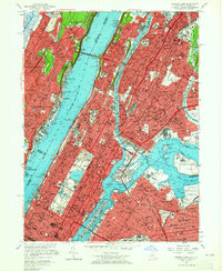
1956 Map of Central Park
USGS Topo · Published 1965About this map
Manhattan Island serves as the focal point of this mid-1950s survey, illustrating a dense urban landscape connected by iconic infrastructure like the George Washington Bridge and the Triborough Bridge. The map captures a high-water mark for mid-century New York, featuring active sporting landmarks such as Yankee Stadium in the Bronx Co and the Polo Grounds before its demolition. Cultural and educational institutions are well-documented, from Columbia University to the Metropolitan Museum of Art situated within the meticulously detailed paths of Central Park. Across the Hudson River, New Jersey communities like Fort Lee and Edgewater sit atop the palisades, while the eastern edge of the map details the burgeoning neighborhoods of Astoria and Long Island City near the New York Municipal Airport. The survey provides a clear look at the intricate network of the New York Central RR and the Pennsylvania Railroad Tunnel supporting the city's industry.
Find a feature on this map
141 named features on this map. Tap any name to fly to it.
Don’t see what you’re looking for? This feature index may not catch every label — zoom into the map to look around manually.
Map Details
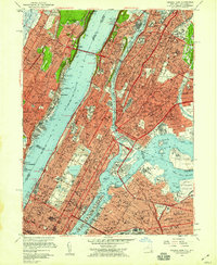
Editions of this 1956 Central Park Map
2 editions found
Other maps of this area

1888 · Paterson
USGS Topo · 1:62,500

1889 · Brooklyn
USGS Topo · 1:62,500

1891 · Brooklyn
USGS Topo · 1:62,500

1891 · Harlem
USGS Topo · 1:62,500

1892 · Paterson
USGS Topo · 1:62,500

1897 · Harlem
USGS Topo · 1:62,500

1897 · Brooklyn
USGS Topo · 1:62,500

1898 · Harlem
USGS Topo · 1:62,500

1898 · Staten Island
USGS Topo · 1:62,500

1898 · Brooklyn
USGS Topo · 1:62,500