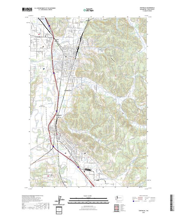
2023 Map of Centralia
USGS Topo · Published 2023About this map
Centralia and Chehalis sit at the heart of this Lewis County landscape, where the Skookumchuck River and Newaukum River converge with the Chehalis River. The area is characterized by a dense concentration of civic and educational landmarks, including Centralia College and the Law and Justice Center. Significant transportation corridors like Interstate 5 and the Willapa Hills State Park Trl navigate the flatlands between Seminary Hill and Ham Hill, illustrating the region's role as a major Pacific Northwest transit hub.
Find a feature on this map
45 named features on this map. Tap any name to fly to it.
Don’t see what you’re looking for? This feature index may not catch every label — zoom into the map to look around manually.
Map Details
Editions of this 2023 Centralia Map
This is the sole edition of this map. No revisions or reprints were ever made.
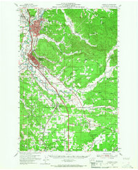
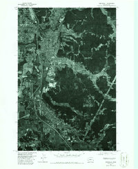
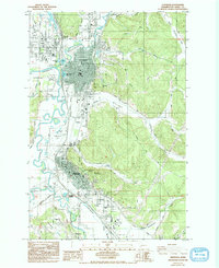
Historical Maps of Fords Prairie Through Time
5 maps found