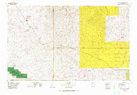
1976 Map of Chaco Canyon
USGS Topo · Published 1978About this map
Chaco Canyon National Monument anchors the southwest corner of this northwestern New Mexico landscape, preserving a concentration of ancient habitation sites along Gallo Wash and the Chaco River. The 1970s era represented here is defined by a remote network of outposts, including Huerfano Trading Post, Blanco Trading Post, and Tsah Tah Trading Post, which served as critical economic hubs for local communities. The terrain is marked by significant topographical boundaries, with the Continental Divide cutting across the southeast while the Jicarilla Apache Indian Reservation occupies much of the eastern half of the quadrangle.
Find a feature on this map
88 named features on this map. Tap any name to fly to it.
Don’t see what you’re looking for? This feature index may not catch every label — zoom into the map to look around manually.
Map Details
Editions of this 1976 Chaco Canyon Map
This is the sole edition of this map. No revisions or reprints were ever made.
Other maps of this area

1883 · Mt. Taylor
USGS Topo · 1:250,000

1886 · Wingate
USGS Topo · 1:250,000

1886 · Mt. Taylor
USGS Topo · 1:250,000

1889 · Largo
USGS Topo · 1:250,000

1889 · Chaco
USGS Topo · 1:250,000

1890 · Jemes
USGS Topo · 1:125,000

1892 · Jemes
USGS Topo · 1:125,000

1892 · Wingate
USGS Topo · 1:250,000

1892 · Chaco
USGS Topo · 1:250,000

1892 · Mt. Taylor
USGS Topo · 1:250,000
Featured Places
- Eastern Navajo Agency, NM
- Blanco Trading Post, NM
- Lindrith, NM
- Lybrook, NM
- Counselor, Eastern Navajo Agency