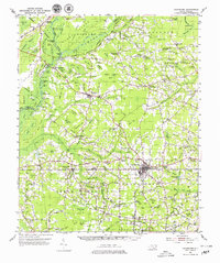
1953 Map of Chadbourn
USGS Topo · Published 1979About this map
The Lumber River and the Atlantic Coast Line railroad define the geography of Columbus County in this mid-century survey. The landscape is dominated by a distinctive pattern of elliptical depressions known locally as bays, including Rough Bay, Cow Bay, and Flat Bay, which dictate the placement of roads and farms. The town of Chadbourn serves as a central hub, appearing here during a period of steady growth before modern highway expansions.
Find a feature on this map
138 named features on this map. Tap any name to fly to it.
Don’t see what you’re looking for? This feature index may not catch every label — zoom into the map to look around manually.
Map Details
Editions of this 1953 Chadbourn Map
2 editions found
Other maps of this area

1943 · Pages Mill
USGS Topo · 1:62,500

1943 · Nakina
USGS Topo · 1:24,000

1949 · Duford
USGS Topo · 1:24,000

1953 · Chadbourn
USGS Topo · 1:62,500

1953 · Florence
USGS Topo · 1:250,000

1954 · Florence
USGS Topo · 1:250,000

1955 · Whiteville
USGS Topo · 1:62,500

1955 · Elizabethtown
USGS Topo · 1:62,500

1957 · Bladenboro
USGS Topo · 1:62,500

1962 · Fair Bluff
USGS Topo · 1:24,000