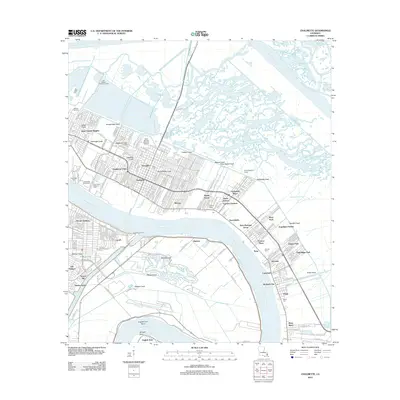
2012 Map of Chalmette
USGS Topo · Published 2012About this map
The Mississippi River winds through the heart of St. Bernard Parish, anchoring a landscape defined by its complex relationship with water and memory. The iconic Chalmette Battlefield and adjacent Chalmette National Cemetery stand as significant historical anchors near the Old Jackson Protection Levee. The map illustrates the region's dense network of drainage and transport canals, including the substantial Mississippi River-Gulf Outlet Canal and the historic Forty Arpent Canal, which border residential developments like Versailles, Meraux, and Lexington Place. To the south, the deep curve of the English Turn Bend marks a transition toward more open terrain, where Docville Farm and the Planters Canal reflect the area's agricultural heritage. This 2012 survey documents the suburban footprint of communities like Saint Claude Heights and Violet alongside vital defensive infrastructure like the Back Protection Levee.
Find a feature on this map
67 named features on this map. Tap any name to fly to it.
Don’t see what you’re looking for? This feature index may not catch every label — zoom into the map to look around manually.
Map Details
Editions of this 2012 Chalmette Map
This is the sole edition of this map. No revisions or reprints were ever made.
Other maps of this area

1891 · Spanish Fort
USGS Topo · 1:62,500

1891 · New Orleans
USGS Topo · 1:62,500

1892 · Chef Menteur
USGS Topo · 1:62,500

1892 · St. Bernard
USGS Topo · 1:62,500

1932 · New Orleans NE
USGS Topo · 1:31,680

1932 · New Orleans SE
USGS Topo · 1:31,680

1935 · Delacroix
USGS Topo · 1:31,680

1936 · Chef Menteur
USGS Topo · 1:62,500

1936 · Spanish Fort
USGS Topo · 1:62,500

1937 · Chef Menteur
USGS Topo · 1:31,680