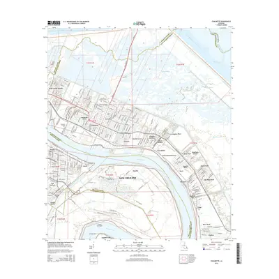
2015 Map of Chalmette
USGS Topo · Published 2015About this map
The Mississippi River carves a dramatic arc through this coastal landscape, defining the boundaries between Orleans, St. Bernard, and Plaquemines Parishes. This area is a complex network of industrial waterways and suburban growth, where the Mississippi River-Gulf Outlet Canal and the Intracoastal Waterway intersect the marshlands. Historical memory is anchored by the Chalmette National Cemetery and the Saint Bernard Memorial Gardens, while educational centers like Nunez Community College and Our Lady of Holy Cross College mark the local communities. The residential development follows the natural levees of the river, moving from Chalmette and Versailles through a series of planned neighborhoods such as Meraux, Saxonholm, and Violet. To the south, the deep curve of English Turn Bend remains a prominent navigational landmark, surrounded by the wetlands of Shingle Point and the community of Poydras.
Find a feature on this map
72 named features on this map. Tap any name to fly to it.
Don’t see what you’re looking for? This feature index may not catch every label — zoom into the map to look around manually.
Map Details
Editions of this 2015 Chalmette Map
This is the sole edition of this map. No revisions or reprints were ever made.
Other maps of this area

1891 · Spanish Fort
USGS Topo · 1:62,500

1891 · New Orleans
USGS Topo · 1:62,500

1892 · Chef Menteur
USGS Topo · 1:62,500

1892 · St. Bernard
USGS Topo · 1:62,500

1932 · New Orleans NE
USGS Topo · 1:31,680

1932 · New Orleans SE
USGS Topo · 1:31,680

1935 · Delacroix
USGS Topo · 1:31,680

1936 · Chef Menteur
USGS Topo · 1:62,500

1936 · Spanish Fort
USGS Topo · 1:62,500

1937 · Chef Menteur
USGS Topo · 1:31,680