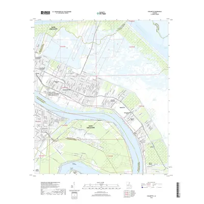
2018 Map of Chalmette
USGS Topo · Published 2018About this map
The Mississippi River winds through this landscape, defining the transition from the developed riverside communities of Chalmette, Meraux, and Violet to the expansive wetlands of the Orleans Parish and St. Bernard Parish border. This area is anchored by the Jean Lafitte National Historical Park and Perserve, which protects the grounds of the Chalmette National Cem and the adjacent Freedmen's Cem. These sites, along with the NG Jackson Barracks, speak to the deep military and social history of the region.
Find a feature on this map
239 named features on this map. Tap any name to fly to it.
Don’t see what you’re looking for? This feature index may not catch every label — zoom into the map to look around manually.
Map Details
Editions of this 2018 Chalmette Map
This is the sole edition of this map. No revisions or reprints were ever made.
Other maps of this area

1891 · Spanish Fort
USGS Topo · 1:62,500

1891 · New Orleans
USGS Topo · 1:62,500

1892 · Chef Menteur
USGS Topo · 1:62,500

1892 · St. Bernard
USGS Topo · 1:62,500

1932 · New Orleans NE
USGS Topo · 1:31,680

1932 · New Orleans SE
USGS Topo · 1:31,680

1935 · Delacroix
USGS Topo · 1:31,680

1936 · Chef Menteur
USGS Topo · 1:62,500

1936 · Spanish Fort
USGS Topo · 1:62,500

1937 · Chef Menteur
USGS Topo · 1:31,680