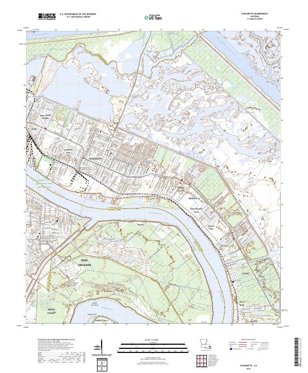
2024 Map of Chalmette
USGS Topo · Published 2024About this map
The Mississippi River snakes through this industrial and coastal landscape, defining the boundaries of Chalmette, Arabi, and New Orleans. The map reveals the intricate water management system essential to the region, featuring the Intracoastal Waterway, the Mississippi River-Gulf Outlet Canal, and the Florida-Walk Canal. Along the riverbanks, traditional land patterns are evident at English Turn Bend and Shingle Point, while the interior shows the dense suburban development of Chalmette Vista and Saint Claude Heights.
Find a feature on this map
59 named features on this map. Tap any name to fly to it.
Don’t see what you’re looking for? This feature index may not catch every label — zoom into the map to look around manually.
Map Details
Editions of this 2024 Chalmette Map
This is the sole edition of this map. No revisions or reprints were ever made.
Other maps of this area

1891 · Spanish Fort
USGS Topo · 1:62,500

1891 · New Orleans
USGS Topo · 1:62,500

1892 · Chef Menteur
USGS Topo · 1:62,500

1892 · St. Bernard
USGS Topo · 1:62,500

1932 · New Orleans NE
USGS Topo · 1:31,680

1932 · New Orleans SE
USGS Topo · 1:31,680

1935 · Delacroix
USGS Topo · 1:31,680

1936 · Chef Menteur
USGS Topo · 1:62,500

1936 · Spanish Fort
USGS Topo · 1:62,500

1937 · Chef Menteur
USGS Topo · 1:31,680