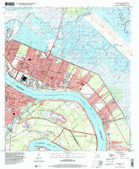
1998 Map of Chalmette
USGS Topo · Published 2001About this map
The Mississippi River creates a massive loop through the heart of this coastal Louisiana landscape, defining the boundaries between St. Bernard and Orleans parishes. This late 1990s environment is dominated by the concentrated development of Chalmette, Meraux, and Violet, which are constrained between the river's high levee and the expansive wetlands to the north. Industrial and military importance is evident through the Jackson Barracks on the parish line and the extensive US Coast Guard Reservation further south.
Find a feature on this map
61 named features on this map. Tap any name to fly to it.
Don’t see what you’re looking for? This feature index may not catch every label — zoom into the map to look around manually.
Map Details
Editions of this 1998 Chalmette Map
This is the sole edition of this map. No revisions or reprints were ever made.
Other maps of this area

1891 · Spanish Fort
USGS Topo · 1:62,500

1891 · New Orleans
USGS Topo · 1:62,500

1892 · Chef Menteur
USGS Topo · 1:62,500

1892 · St. Bernard
USGS Topo · 1:62,500

1932 · New Orleans NE
USGS Topo · 1:31,680

1932 · New Orleans SE
USGS Topo · 1:31,680

1935 · Delacroix
USGS Topo · 1:31,680

1936 · Chef Menteur
USGS Topo · 1:62,500

1936 · Spanish Fort
USGS Topo · 1:62,500

1937 · Chef Menteur
USGS Topo · 1:31,680