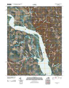
2010 Map of Champlain
USGS Topo · Published 2010About this map
The Rappahannock River dominates this landscape, its wide channel and intricate marshes defining the geography of Richmond County. Along its banks, the dramatic elevations of Fones Cliffs overlook a network of landings and wharves that speak to the region's river-based heritage, including Carters Wharf, Baird Landing, and Daingerfield Landing. The inland areas are a mix of agricultural history and small settlements like Leedstown and Champlain, punctuated by long-standing family farmsteads such as Malvale Farm and Lindsay Hall Farm.
Find a feature on this map
64 named features on this map. Tap any name to fly to it.
Don’t see what you’re looking for? This feature index may not catch every label — zoom into the map to look around manually.
Map Details
Editions of this 2010 Champlain Map
This is the sole edition of this map. No revisions or reprints were ever made.
Other maps of this area

1889 · Fredericksburg
USGS Topo · 1:125,000

1892 · Fredericksburg
USGS Topo · 1:125,000

1892 · Montross
USGS Topo · 1:62,500

1894 · Fredericksburg
USGS Topo · 1:125,000

1895 · Nomini
USGS Topo · 1:125,000

1895 · Montross
USGS Topo · 1:62,500

1898 · Nomini
USGS Topo · 1:125,000

1918 · Tappahannock
USGS Topo · 1:62,500

1918 · Aylett
USGS Topo · 1:62,500

1919 · Tappahannock
USGS Topo · 1:62,500