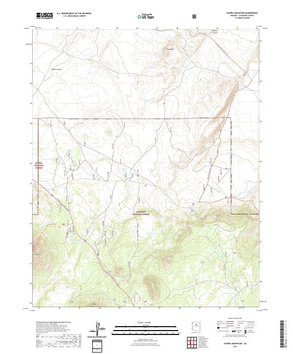
2021 Map of Chapel Mountain
USGS Topo · Published 2021About this map
High-altitude ranching and forest lands define this region of Coconino County, where the high desert meets the volcanic peaks of northern Arizona. The landscape is marked by essential water resources for livestock and wildlife, including Babbitt Lake, North Pasture Tank, and the CO Bar Tank. These water sources are critical features in a terrain dominated by significant elevations like Chapel Mtn and Slate Mtn. The map highlights a network of trails and primitive roads that navigate the complex topography, most notably the Arizona National Scenic Trl which traverses the eastern sections of the quadrangle.
Find a feature on this map
26 named features on this map. Tap any name to fly to it.
Don’t see what you’re looking for? This feature index may not catch every label — zoom into the map to look around manually.
Map Details
Editions of this 2021 Chapel Mountain Map
This is the sole edition of this map. No revisions or reprints were ever made.
Other maps of this area

1886 · San Francisco Mtns
USGS Topo · 1:250,000

1891 · San Francisco Mtns
USGS Topo · 1:250,000

1894 · San Francisco Mtns
USGS Topo · 1:250,000

1899 · San Francisco Mtns
USGS Topo · 1:250,000

1908 · Flagstaff
USGS Topo · 1:125,000

1912 · Flagstaff
USGS Topo · 1:125,000

1947 · Flagstaff
USGS Topo · 1:250,000

1954 · Flagstaff
USGS Topo · 1:250,000

1958 · Flagstaff
USGS Topo · 1:250,000

1960 · Flagstaff
USGS Topo · 1:250,000