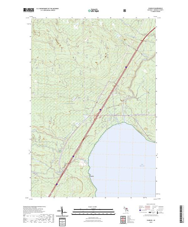
2023 Map of Charles
USGS Topo · Published 2023About this map
Saint Martin Bay defines the southern edge of this Mackinac County landscape, where the waters of Lake Huron meet a heavily forested interior protected by the Hiawatha National Forest. The small settlement of Charles sits near the shoreline, serving as a quiet focal point in a region dominated by hydrologic networks and conservation lands. The Carp Wild and Scenic River and the Pine River snake through the terrain, supported by smaller tributaries like McCloud Creek and Garden Hill Creek. This modern survey illustrates a landscape managed for both preservation and recreation, with significant acreage dedicated to the Horseshoe Bay Wilderness. A complex system of trails, including the Fisherman's Hike Trl and the Red Creek-cedarville Snomo Trl, indicates the importance of seasonal access and outdoor transit in the Upper Peninsula's coastal forests.
Find a feature on this map
24 named features on this map. Tap any name to fly to it.
Don’t see what you’re looking for? This feature index may not catch every label — zoom into the map to look around manually.
Map Details
Editions of this 2023 Charles Map
This is the sole edition of this map. No revisions or reprints were ever made.
Other maps of this area

1931 · St Ignace NW
USGS Topo · 1:31,680

1931 · Moran NE
USGS Topo · 1:31,680

1931 · Ozark SE
USGS Topo · 1:31,680

1932 · St Ignace NE
USGS Topo · 1:31,680

1948 · Moran NE
USGS Topo · 1:31,680
1953 · Rudyard
USGS Topo · 1:24,000

1953 · Fibre
USGS Topo · 1:24,000

1954 · Sault Sainte Marie
USGS Topo · 1:250,000

1955 · Cheboygan
USGS Topo · 1:250,000

1956 · Sault Sainte Marie
USGS Topo · 1:250,000