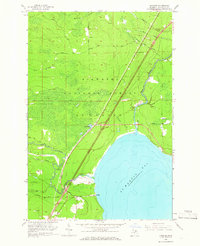
1964 Map of Charles
USGS Topo · Published 1966About this map
St Martin Bay defines the southeastern shoreline of this 1960s study, where the waters of Lake Huron meet the densely forested interior of the Hiawatha National Forest. The settlement of Charles sits near the coast, supported by a network of rural routes like Gorman Road and Charles Road. Inland, the landscape is shaped by the winding courses of the Pine River and the Carp River, the latter of which features the Carp River Campground near its banks.
Find a feature on this map
31 named features on this map. Tap any name to fly to it.
Don’t see what you’re looking for? This feature index may not catch every label — zoom into the map to look around manually.
Map Details
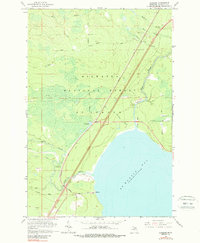
Editions of this 1964 Charles Map
2 editions found
Other maps of this area

1931 · St Ignace NW
USGS Topo · 1:31,680

1931 · Moran NE
USGS Topo · 1:31,680

1931 · Ozark SE
USGS Topo · 1:31,680

1932 · St Ignace NE
USGS Topo · 1:31,680

1948 · Moran NE
USGS Topo · 1:31,680
1953 · Rudyard
USGS Topo · 1:24,000

1953 · Fibre
USGS Topo · 1:24,000

1954 · Sault Sainte Marie
USGS Topo · 1:250,000

1955 · Cheboygan
USGS Topo · 1:250,000

1956 · Sault Sainte Marie
USGS Topo · 1:250,000