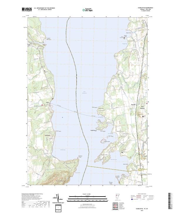
2024 Map of Charlotte
USGS Topo · Published 2024About this map
The waters of Lake Champlain define the geography of this area, separating the New York shoreline near Essex from the Vermont coast at Charlotte. A vital maritime connection is maintained via the Essex Ferry, which crosses the lake between Cannon Point and the Vermont landings. The landscape is dotted with small settlements and family-named landmarks, reflecting a long history of agricultural and recreational use along the lake. Significant burial sites such as Meach Island Cem and Barber Cem provide important links for genealogical research, while the presence of Bostwick Farm Airport and E A Deeds Farm Airport indicates the persistent role of private aviation in these rural communities. The terrain transitions from the elevations of Split-Rock Mountain on the western shore to the prominent peninsulas of Thompsons Point and Wings Point to the east.
Find a feature on this map
101 named features on this map. Tap any name to fly to it.
Don’t see what you’re looking for? This feature index may not catch every label — zoom into the map to look around manually.
Map Details
Editions of this 2024 Charlotte Map
This is the sole edition of this map. No revisions or reprints were ever made.
Other maps of this area

1894 · Port Henry
USGS Topo · 1:62,500

1895 · Willsboro
USGS Topo · 1:62,500

1898 · Port Henry
USGS Topo · 1:62,500

1903 · Middlebury
USGS Topo · 1:62,500

1905 · Middlebury
USGS Topo · 1:62,500

1906 · Burlington
USGS Topo · 1:62,500

1919 · Burlington
USGS Topo · 1:62,500

1920 · Middlebury
USGS Topo · 1:62,500

1941 · Willsboro
USGS Topo · 1:62,500

1943 · Willsboro
USGS Topo · 1:62,500