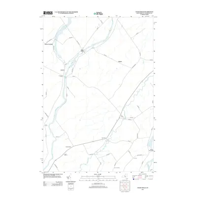
2013 Map of Chase Mills
USGS Topo · Published 2013About this map
Grass River and Raquette River anchor this St. Lawrence County landscape, defining the rural character of the region. The small settlement of Chase Mills serves as a local hub, complete with its own post office situated near the riverbanks. The surrounding terrain is characterized by agricultural stretches and small crossroads communities like Dishaw, Chamberlain Corners, and Smith Corners. Genealogists can find significant local history through family-named landmarks and several burial grounds, including Chamberlain Corners Cem, Haskell Ridge Cem, and Clark Cem.
Find a feature on this map
54 named features on this map. Tap any name to fly to it.
Don’t see what you’re looking for? This feature index may not catch every label — zoom into the map to look around manually.
Map Details
Editions of this 2013 Chase Mills Map
This is the sole edition of this map. No revisions or reprints were ever made.
Other maps of this area

1905 · Waddington
USGS Topo · 1:62,500

1906 · Massena
USGS Topo · 1:62,500

1907 · Massena
USGS Topo · 1:62,500

1908 · Potsdam
USGS Topo · 1:62,500

1910 · Canton
USGS Topo · 1:62,500

1911 · Canton
USGS Topo · 1:62,500

1942 · Waddington
USGS Topo · 1:24,000

1942 · Chase Mills
USGS Topo · 1:24,000

1942 · Murphy Island
USGS Topo · 1:24,000

1942 · Norfolk
USGS Topo · 1:24,000