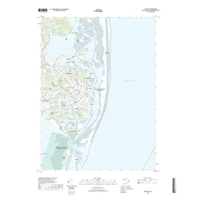
2018 Map of Chatham
USGS Topo · Published 2018About this map
Chatham and its coastal surroundings are defined by a complex maritime landscape where the Atlantic Ocean meets protected waters like Pleasant Bay and Oyster Pond. This 2018 survey details the intricate network of inlets, marshes, and necks that comprise the shoreline, including Nickersons Neck, Toms Neck, and The Neck. The town's historical depth is evident in its numerous burial sites, from the Old Burying Ground near the Chatham Municipal Airport to the Seaside Cem and Old Baptist Cem closer to the village center.
Find a feature on this map
147 named features on this map. Tap any name to fly to it.
Don’t see what you’re looking for? This feature index may not catch every label — zoom into the map to look around manually.
Map Details
Editions of this 2018 Chatham Map
This is the sole edition of this map. No revisions or reprints were ever made.
Other maps of this area

1887 · Wellfleet
USGS Topo · 1:62,500

1887 · Yarmouth
USGS Topo · 1:62,500

1888 · Chatham
USGS Topo · 1:62,500

1889 · Yarmouth
USGS Topo · 1:62,500

1889 · Wellfleet
USGS Topo · 1:62,500

1893 · Chatham
USGS Topo · 1:62,500

1893 · Yarmouth
USGS Topo · 1:62,500

1893 · Wellfleet
USGS Topo · 1:62,500

1917 · Chatham
USGS Topo · 1:62,500

1942 · Cape Cod Bay
USGS Topo · 1:125,000