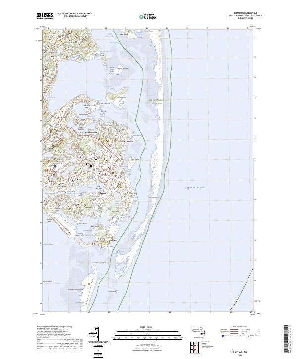
2024 Map of Chatham
USGS Topo · Published 2024About this map
Chatham and its coastal surroundings are defined by a complex landscape of glacial ponds and tidal inlets along the Atlantic shore. The settlement pattern is anchored by several distinct villages, including Chatham Port, North Chatham, and West Chatham, while the southern reaches transition into the protected dunes of the Monomoy National Wildlife Refuge. Numerous freshwater bodies like Lovers Lake and Sarahs Pond are interspersed with historical sites, particularly a high concentration of burial grounds such as the Old Baptist Cem and the Smallpox Cem. Modern recreation and transportation are visible through the Cape Cod Rail Trail (Chatham Ext) and the Chatham Municipal Airport. This 2024 data illustrates the modern conservation boundaries of the Cape Cod National Seashore alongside centuries-old family-named landmarks like Uncle Israels Pond and Sipson Island.
Find a feature on this map
95 named features on this map. Tap any name to fly to it.
Don’t see what you’re looking for? This feature index may not catch every label — zoom into the map to look around manually.
Map Details
Editions of this 2024 Chatham Map
This is the sole edition of this map. No revisions or reprints were ever made.
Other maps of this area

1887 · Wellfleet
USGS Topo · 1:62,500

1887 · Yarmouth
USGS Topo · 1:62,500

1888 · Chatham
USGS Topo · 1:62,500

1889 · Yarmouth
USGS Topo · 1:62,500

1889 · Wellfleet
USGS Topo · 1:62,500

1893 · Chatham
USGS Topo · 1:62,500

1893 · Yarmouth
USGS Topo · 1:62,500

1893 · Wellfleet
USGS Topo · 1:62,500

1917 · Chatham
USGS Topo · 1:62,500

1942 · Cape Cod Bay
USGS Topo · 1:125,000