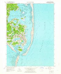
1961 Map of Chatham
USGS Topo · Published 1964About this map
Chatham and its coastal villages appear in great detail during the early 1960s, showing a landscape defined by an intricate network of salt water ponds, coves, and barrier beaches. The map illustrates the town's maritime orientation, with the Chatham Lighthouse standing watch over the Atlantic and the Chatham Yacht Club situated on Nickersons Neck. Dense development is concentrated around North Chatham and West Chatham, while the southern reaches extend into the National Wildlife Refuge on Monomoy Island. Evidence of the region's agricultural and industrial past remains visible through numerous Cranberry Bogs and a Quarry near Oyster Pond. Local geography is intricately labeled, from the tidal flats of Bassing Harbor to the quiet inland waters of Lovers Lake and Stillwater Pond, providing a clear record of the shoreline before decades of coastal erosion and shifting sands.
Find a feature on this map
84 named features on this map. Tap any name to fly to it.
Don’t see what you’re looking for? This feature index may not catch every label — zoom into the map to look around manually.
Map Details
Editions of this 1961 Chatham Map
2 editions found
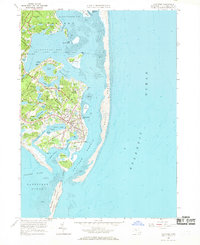
Other maps of this area

1887 · Wellfleet
USGS Topo · 1:62,500

1887 · Yarmouth
USGS Topo · 1:62,500

1888 · Chatham
USGS Topo · 1:62,500

1889 · Yarmouth
USGS Topo · 1:62,500

1889 · Wellfleet
USGS Topo · 1:62,500

1893 · Chatham
USGS Topo · 1:62,500

1893 · Yarmouth
USGS Topo · 1:62,500

1893 · Wellfleet
USGS Topo · 1:62,500

1917 · Chatham
USGS Topo · 1:62,500

1942 · Cape Cod Bay
USGS Topo · 1:125,000