
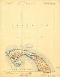
1993 Map of Chatham
USGS Topo · Published 1994About this map
Cape Cod National Seashore dominates the shoreline of this 1993 edition, illustrating the protected maritime landscape of the outer Cape. This survey, compiled from data by the U.S. Geological Survey and the National Ocean Service, captures a detailed view of the coastal interface, from the northern hollows like Newcomb Hollow to the southern tip of Monomoy Island. The map records the precise locations of navigational landmarks such as the Nauset Beach Lighthouse and Chatham Light, alongside the inland clusters of Wellfleet, Eastham, and Orleans.
Find a feature on this map
57 named features on this map. Tap any name to fly to it.
Don’t see what you’re looking for? This feature index may not catch every label — zoom into the map to look around manually.
Map Details
Editions of this 1993 Chatham Map
This is the sole edition of this map. No revisions or reprints were ever made.
Other maps of this area

1887 · Wellfleet
USGS Topo · 1:62,500

1887 · Yarmouth
USGS Topo · 1:62,500

1887 · Provincetown
USGS Topo · 1:62,500

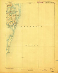
1888 · Chatham
USGS Topo · 1:62,500

1889 · Yarmouth
USGS Topo · 1:62,500
1889 · Provincetown
USGS Topo · 1:62,500

1889 · Wellfleet
USGS Topo · 1:62,500
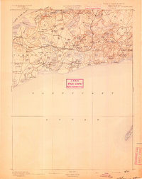
1893 · Chatham
USGS Topo · 1:62,500
1893 · Yarmouth
USGS Topo · 1:62,500
1893 · Wellfleet
USGS Topo · 1:62,500