2024 Map of Chatham
USGS Topo · Published 2024About this map
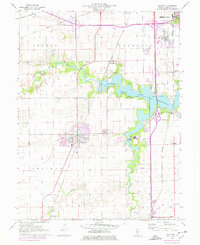
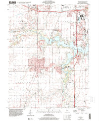
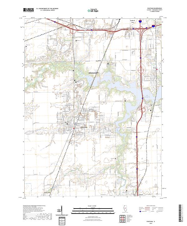
Chatham and the southern outskirts of Springfield form the core of this Illinois landscape, where established neighborhoods meet the expansive waters of Lake Springfield. The area is characterized by a significant number of burial sites, including Chatham Memorial Cem, Easley Cem, and Saint Bernard Cem, which offer important touchpoints for family history research. Modern developments are visible in the dense street grids of Chatham and Southern View, while the outlying areas maintain a connection to the natural hydrology of Lick Creek and Panther Creek. The presence of the Canadian Cross Rd and major thoroughfares like S Veterans Pkwy illustrate the region's transport network. Further south, the map documents smaller localities such as Glenarm and Irwins Park, providing a detailed look at the interface between growing residential zones and the Sangamon County prairie.
Find a feature on this map
185 named features on this map. Tap any name to fly to it.
Don’t see what you’re looking for? This feature index may not catch every label — zoom into the map to look around manually.
Map Details
Editions of this 2024 Chatham Map
This is the sole edition of this map. No revisions or reprints were ever made.
Historical Maps of Toronto Through Time
3 maps found