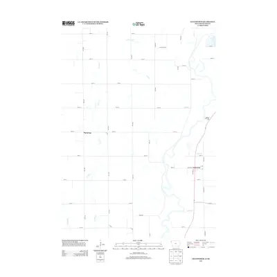
2013 Map of Chatsworth
USGS Topo · Published 2013About this map
Chatsworth and Big Springs anchor this 2013 topographic study of the borderlands between Iowa and South Dakota. The landscape is defined by a dense grid of section roads and a complex network of waterways, including the winding Indian Cr and Sixmile Cr. Local infrastructure is highlighted by specialized routes like Elevator Rd and School House Rd, reflecting the region's agricultural and community-oriented development. To the north, the terrain is carved by Scott Cr and Green Cr, while the Highway Twelve Rest Area provides a modern navigational point along the eastern corridor. The map preserves the specific placement of rural residences and the exact drainage patterns of E Union Cr and W Union Cr, which join the larger stream systems flowing through this prairie territory.
Find a feature on this map
42 named features on this map. Tap any name to fly to it.
Don’t see what you’re looking for? This feature index may not catch every label — zoom into the map to look around manually.
Map Details
Editions of this 2013 Chatsworth Map
This is the sole edition of this map. No revisions or reprints were ever made.
Other maps of this area

1897 · Canton
USGS Topo · 1:125,000

1898 · Elk Point
USGS Topo · 1:125,000

1900 · Canton
USGS Topo · 1:125,000

1901 · Elk Point
USGS Topo · 1:125,000

1907 · Elk Point
USGS Topo · 1:125,000

1955 · Sioux City
USGS Topo · 1:250,000

1955 · Sioux Falls
USGS Topo · 1:250,000

1958 · Sioux City
USGS Topo · 1:250,000

1958 · Sioux Falls
USGS Topo · 1:250,000

1959 · Sioux City
USGS Topo · 1:250,000