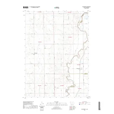
2018 Map of Chatsworth
USGS Topo · Published 2018About this map
The Big Sioux River meanders along the border of Iowa and South Dakota, carving a complex valley that defines the landscape of Hawarden and Chatsworth. This agricultural corridor is marked by a deep-rooted settlement history, evidenced by the clustered burial sites such as Old Big Springs Cem and the nearby Big Springs Cem on the western uplands. The drainage network is particularly dense here, with Scott Cr, Sixmile Cr, and the forks of E Union Cr and W Union Cr feeding into the main river channel. In the south, Mount Hope Cem and Union Creek Cem sit near the junction of Union and Plymouth counties. The map illustrates the grid-based rural road system typical of the Midwest, punctuated by small communities and established homesteads that have shaped the region's development since the late 19th century.
Find a feature on this map
89 named features on this map. Tap any name to fly to it.
Don’t see what you’re looking for? This feature index may not catch every label — zoom into the map to look around manually.
Map Details
Editions of this 2018 Chatsworth Map
This is the sole edition of this map. No revisions or reprints were ever made.
Other maps of this area

1897 · Canton
USGS Topo · 1:125,000

1898 · Elk Point
USGS Topo · 1:125,000

1900 · Canton
USGS Topo · 1:125,000

1901 · Elk Point
USGS Topo · 1:125,000

1907 · Elk Point
USGS Topo · 1:125,000

1955 · Sioux City
USGS Topo · 1:250,000

1955 · Sioux Falls
USGS Topo · 1:250,000

1958 · Sioux City
USGS Topo · 1:250,000

1958 · Sioux Falls
USGS Topo · 1:250,000

1959 · Sioux City
USGS Topo · 1:250,000