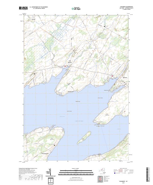
2023 Map of Chaumont
USGS Topo · Published 2023About this map
The eastern shore of Lake Ontario defines this part of Jefferson County, where the sprawling Point Peninsula extends into Chaumont Bay. This modern survey records a landscape shaped by its maritime geography, from the sheltered waters of Three Mile Bay to the recreation areas of Long Point State Park. Small clusters of settlement like Chaumont and Three Mile Bay are concentrated along the shoreline, connected by a network of county roads that cut through the agricultural interiors near Rosiere.
Find a feature on this map
84 named features on this map. Tap any name to fly to it.
Don’t see what you’re looking for? This feature index may not catch every label — zoom into the map to look around manually.
Map Details
Editions of this 2023 Chaumont Map
This is the sole edition of this map. No revisions or reprints were ever made.
Other maps of this area

1893 · Sackets Harbor
USGS Topo · 1:62,500

1895 · Sacketts Harbor
USGS Topo · 1:62,500

1895 · Stony Island
USGS Topo · 1:62,500

1895 · Cape Vincent
USGS Topo · 1:62,500

1900 · Clayton
USGS Topo · 1:62,500

1903 · Clayton
USGS Topo · 1:62,500

1942 · Cape Vincent North
USGS Topo · 1:31,680

1942 · Henderson Bay
USGS Topo · 1:31,680

1942 · Chaumont
USGS Topo · 1:31,680

1942 · Sawmill Bay
USGS Topo · 1:31,680