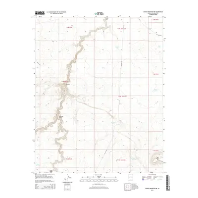
2014 Map of Chavez Mountain NE
USGS Topo · Published 2014About this map
Canyon Diablo snakes through this high-elevation landscape in Coconino County, carving a deep, winding path through the arid plateau. The 2014 survey reveals a terrain defined by its water management and grazing history, evidenced by a network of catchments such as Buck Tank, Limestone Tank, and Broken Dam Tank. To the southwest, the steep-walled Grapevine Canyon feeds into the larger system, while the prominent rise of West Sunset Mtn anchors the southeastern corner.
Find a feature on this map
26 named features on this map. Tap any name to fly to it.
Don’t see what you’re looking for? This feature index may not catch every label — zoom into the map to look around manually.
Map Details
Editions of this 2014 Chavez Mountain NE Map
This is the sole edition of this map. No revisions or reprints were ever made.
Other maps of this area

1883 · Tusayan
USGS Topo · 1:250,000

1886 · Tusayan
USGS Topo · 1:250,000

1886 · San Francisco Mtns
USGS Topo · 1:250,000

1886 · Holbrook
USGS Topo · 1:250,000

1887 · Verde
USGS Topo · 1:250,000

1891 · San Francisco Mtns
USGS Topo · 1:250,000

1892 · Verde
USGS Topo · 1:250,000

1893 · Holbrook
USGS Topo · 1:250,000

1894 · San Francisco Mtns
USGS Topo · 1:250,000

1899 · San Francisco Mtns
USGS Topo · 1:250,000