
Loading...
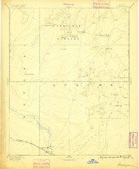
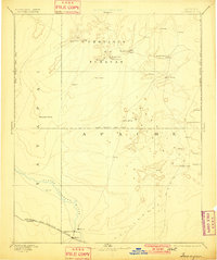
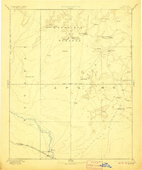
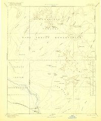
Loading map...1886 Map of Tusayan
USGS Topo · Published 1886About this map
The Province of Tusayan centers this late-19th-century reconnaissance, capturing the high-desert mesa settlements of the Hopi people decades before modern infrastructure transformed the region. The map documents the clustered villages of Oraibi, Shi-pau-i-luvi, Mi-shong-i-nivi, Shi-mo-pavi, Tewa, Sichom-ivi, and Wolpi, which are situated on the finger-like mesas of the north. To the east, Keams Cañon appears as a primary point of contact and supply in this arid landscape.
Find a feature on this map
31 named features on this map. Tap any name to fly to it.
Don’t see what you’re looking for? This feature index may not catch every label — zoom into the map to look around manually.
Map Details
Date Portrayed1886
Date Published1886
PublisherU.S. Geological Survey
Map TypeTopographic
Scale1:250,000
Physical Dimensions16.5 x 19.7 inches
Editions of this 1886 Tusayan Map
5 editions found
Historical Maps of Winslow Through Time

Featured Locations
Source Details
SourceU.S. Geological Survey
CopyrightPublic Domain