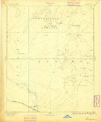
1886 Map of Tusayan
USGS Topo · Published 1891About this map
The Province of Tusayan was surveyed in the early 1880s, revealing a landscape defined by ancestral mesas and the emerging infrastructure of the Southwest. Significant Hopi settlements such as Oraibi, Walpi, and Sichom-ivi are positioned atop the high plateaus, while the Moki Indian Res. Line demarks the territory. This early reconnaissance records the concentration of population in traditional villages during a time of intense geological and ethnological study by federal agencies.
Find a feature on this map
30 named features on this map. Tap any name to fly to it.
Don’t see what you’re looking for? This feature index may not catch every label — zoom into the map to look around manually.
Map Details
Editions of this 1886 Tusayan Map
5 editions found
Other maps of this area

1883 · Marsh Pass
USGS Topo · 1:250,000

1883 · Tusayan
USGS Topo · 1:250,000

1886 · St Johns
USGS Topo · 1:250,000

1886 · Tusayan
USGS Topo · 1:250,000

1886 · Fort Defiance
USGS Topo · 1:250,000

1886 · San Francisco Mtns
USGS Topo · 1:250,000

1886 · Echo Cliffs
USGS Topo · 1:250,000

1886 · Holbrook
USGS Topo · 1:250,000

1887 · Verde
USGS Topo · 1:250,000

1891 · San Francisco Mtns
USGS Topo · 1:250,000