Old Maps of Apache County, Arizona
Explore 1,297 old maps of Apache County, spanning from 1883 to today. These high-resolution historic maps reveal how streets, neighborhoods, landmarks, and natural features evolved over time — perfect for genealogy, metal detecting, research, and local history exploration.
What you can do with these maps:
- See how Apache County changed over time: Compare historical maps to modern-day views to trace roads, homesites, rail lines & more.
- View detailed metadata: Each map includes creators, publishers, year, scale, and archive source.
- Overlay maps with satellite & LiDAR: Visualize the past alongside modern tools to explore terrain & human change.
- Trusted historical sources: Maps sourced from the USGS, Library of Congress, and other archives.
- Access maps your way: View online, download high-res files, or order prints for personal or research use.
Start exploring old maps of Apache County to uncover forgotten places, hidden landmarks, and the deep history beneath your feet.
Apache County, AZ maps
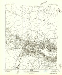
(1,297)- 1883 Map of Marsh Pass
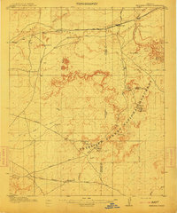
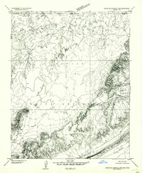
 1883 Marsh Pass1883 Print · USGSNortheastern Arizona was a complex labyrinth of mesas and canyons when this survey was conducted in the early 1880s. Researchers can locate critical desert water sources like Na-pai-bi-to Spring Lake and landmarks like Aga-thla Needle.
 - 1883 Map of Tusayan, 1896 Print
 1883 Tusayan1896 Print · USGSNortheastern Arizona's high desert was entering a period of rapid transition in the 1880s as traditional Hopi life met the expansion of the rail system. Genealogists and historians can trace the foundations of Winslow or explore ancient villages like Oraibi and Walpi.
 - 1886 Map of St Johns
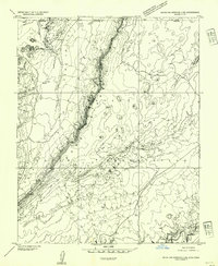
 1886 St Johns1886 Print · USGSApache County in the 1880s was a landscape of emerging pioneer outposts and high-plateau cattle ranching. Researchers can trace the early footprints of settlements like St Johns and Erastus or locate the original path of the Atlantic and Pacific Railroad.
 - 1886 Map of Tusayan
 1886 Tusayan1886 Print · USGSArizona's high desert during the 1880s reveals a unique meeting of ancient mesa villages and the advancing rail line. Genealogists and historians can trace mesa settlements like Wolpi and Oraibi or early rail towns including Brigham City and Winslow.5 unique versions available
 - 1886 Map of Fort Defiance
 1886 Fort Defiance1886 Print · USGSTerritorial Arizona and the high plateaus of Apache County come to life in the 1880s, centered on the strategic outpost of Fort Defiance. Researchers can trace the path of the Atlantic and Pacific Railroad and locate early stops like Allantown and Navajo.
 - 1892 Map of Fort Defiance
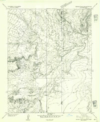
 1892 Fort Defiance1892 Print · USGSNorthern Arizona in the late nineteenth century remains a frontier of isolated outposts and high desert mesas. Trace the path of the A & P R R through Sanders or locate the remote station at Pueblo Colorado and the springs at Jacobs Well.6 unique versions available
 - 1892 Map of Marsh Pass
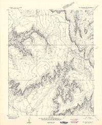
 1892 Marsh Pass1892 Print · USGSNortheastern Arizona and the Navajo lands are shown in the late nineteenth century as a series of immense mesas and critical water sources. You can trace early trails through Marsh Pass and locate remote landmarks like the Agathla Needle or Chil-Chi-Vi-To Spring.4 unique versions available
 - 1892 Map of St Johns
 1892 St Johns1892 Print · USGSArizona's eastern frontier is documented here in the late nineteenth century as cattle ranching and early settlements followed the path of the river. Genealogists and historians can trace the foundations of St Johns and Springerville or locate long-standing sites like Erastus and Windmill Ranch.5 unique versions available
 - 1892 Map of Canyon De Chelly
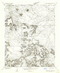
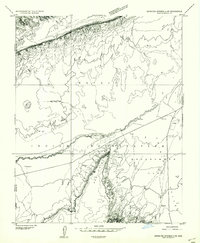
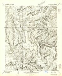
 1892 Canyon De Chelly1892 Print · USGSApache County's high desert and deep sandstone canyons are documented here in the early 1890s, shortly after the initial 1883 survey. Modern researchers can trace the intricate drainages of Canyon De Chelly and find early water sources like Hospitito Spring and Tatezaka Tank.5 unique versions available
 - 1912 Map of Petrified Forest
 1912 Petrified Forest1912 Print · USGSArizona's high desert was a remote frontier of fossils and rail travel just after the turn of the century. Genealogists and historians can trace early outposts like Adamana and Ortegas Ranch or locate archeological sites such as Indian Ruins and The Pictographs.2 unique versions available
 - 1922 Map of Nutrioso
 1922 Nutrioso1922 Print · USGSHigh-altitude ranching and forest service outposts define the Arizona-New Mexico border in the early twenties. Researchers can trace remote family landmarks like Reservation Ranch and Colter's Res. or locate early settlements at Nutrioso and Alpine.
 - 1947 Map of Flagstaff, 1948 Print
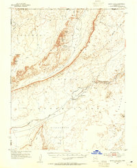
 1947 Flagstaff1948 Print · USGSThe Arizona high country and the Painted Desert converge in this post-war survey. Researchers can trace the ancient mesa villages of Walpi and Oraibi, the early roads of Flagstaff, and landmarks like Sunset Crater National Monument.2 unique versions available
 - 1952 Map of Dinnehotso, 1954 Print
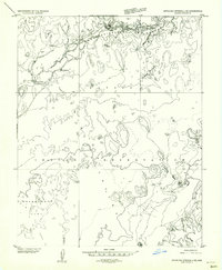
 1952 Dinnehotso1954 Print · USGSThe high desert of the Navajo Nation comes to life in the early fifties, documenting a landscape of isolated trading posts and uranium-era mining. Locate family-named landmarks like Yazzie Mesa or trace the early workings at Monument No 2 Mine.3 unique versions available
 - 1952 Map of Agathla Peak 1 NE, 1954 Print
 1952 Agathla Peak 1 NE1954 Print · USGSThe high desert of the Navajo Nation comes to life in this mid-century survey of the iconic borderlands. Geologists and historians can trace the intricate terrain around Echo Cave Ruin and landmark spires like West Mitten Butte and the Totem Pole.
 - 1952 Map of Agathla Peak 1 SE, 1954 Print
 1952 Agathla Peak 1 SE1954 Print · USGSNortheastern Arizona and the high desert of the Navajo Nation are captured here in the early fifties. Local researchers can trace the course of Laguna Creek past Baby Rocks and across the Navajo Co and Apache Co line.
 - 1952 Map of Setsiltso Springs 2 NW, 1954 Print
 1952 Setsiltso Springs 2 NW1954 Print · USGSThe high desert borderlands of the Arizona-Utah line appear here in the early fifties during an era of expanding resource extraction. Researchers can locate traditional Hogan sites and trace the industrial footprint of the Monument No 2 Mine near Cane Valley.
 - 1952 Map of Setsiltso Springs 2 SW, 1954 Print
 1952 Setsiltso Springs 2 SW1954 Print · USGSApache County land is documented here in the early fifties, showing the high-desert terrain of the Navajo Indian Reservation. Researchers can locate traditional Hogan dwellings and vital water sources like the Windmill and Laguna Creek.
 - 1952 Map of Setsiltso Springs 2 SE, 1954 Print
 1952 Setsiltso Springs 2 SE1954 Print · USGSThe Navajo Nation in the early fifties reveals a landscape of traditional dwellings and vital water infrastructure along Laguna Creek. Trace the sites of Hogans, the community at Dinnehotso, and early water works including a Diversion Dam.
 - 1952 Map of Agathla Peak, 1954 Print
 1952 Agathla Peak1954 Print · USGSThe high desert of the Navajo Nation is captured here in the early fifties, documenting a landscape of ancient ruins and iconic monoliths. Trace historical sites like Echo Cave Ruin and Goulding Well, or locate the towering Agathla Peak and Merrick Butte.3 unique versions available
 - 1952 Map of Setsiltso Springs 2 NE, 1954 Print
 1952 Setsiltso Springs 2 NE1954 Print · USGSThe Arizona-Utah border on the Navajo Indian Reservation was captured in the early fifties before major developments reached this part of Cane Valley. Genealogists and historians can locate traditional Hogans and trace the paths of Sahotsoldbeazhe Creek and Comb Ridge.
 - 1953 Map of Los Gigantes NE, 1954 Print
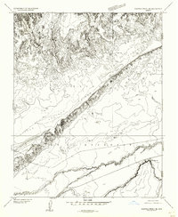
 1953 Los Gigantes NE1954 Print · USGSNavajo Reservation lands in Apache County are captured here in the early fifties, documenting a landscape of high plateaus and vital waterways. Researchers can trace the path of Hasbidito Creek, locate the settlement at Cove, and identify specialized infrastructure like the tunnels.
 - 1953 Map of Los Gigantes NW, 1954 Print
 1953 Los Gigantes NW1954 Print · USGSThe Navajo Nation's intricate canyon country is captured in the early 1950s through precise topographic surveying. Geologists and researchers can trace the winding course of Hasbidito Creek and examine the vast, unnamed mesa formations within the Navajo Indian Reservation.
 - 1953 Map of Redrock Valley NE, 1954 Print
 1953 Redrock Valley NE1954 Print · USGSThe high desert of the Navajo Indian Reservation comes alive in this early 1950s survey of the Four Corners borderlands. Researchers can trace the path of Red Rock Creek or locate isolated landmarks like the Emergency Landing Strip and Oak Spring.
 - 1953 Map of Dinne Mesa NW, 1954 Print
 1953 Dinne Mesa NW1954 Print · USGSThe high desert of the Navajo Nation is captured here in the early 1950s, showing a landscape of mesas and vital water markers. Researchers can trace the proximity to the Red Mesa Trading Post and locate landmarks like the Windmill or Dry Mesa.
 - 1953 Map of Pastora Peak SW, 1954 Print
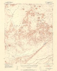
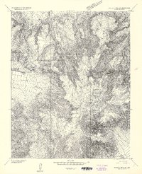 1953 Pastora Peak SW1954 Print · USGSThe Navajo Nation's high mesas and peaks are documented in this early 1950s survey of Apache County. Researchers can trace the rugged topography around VABM Pastora Pk, Zilbetod Pk, and the expansive Toh-Chin-Lini Mesa.
Showing maps 1-25 of 1,297
Top cities of Apache County
- Eagar historical maps
- St. Johns historical maps
- Springerville historical maps
- Dennehotso historical maps
- Alpine historical maps
Frequently asked questions
- What are the different types of historical maps available for Apache County?
- What is the oldest map of Apache County?
- Where can I purchase historical maps of Apache County for my home or office?
- Where can I download high-res historical maps of Apache County?
- Are there historical topographic maps available for Apache County?
- Is there historical aerial imagery available for Apache County?
- Where are historical maps of Apache County sourced from?