
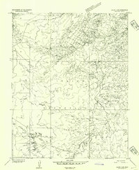
1952 Map of Setsiltso Springs 2 NE
USGS Topo · Published 1954About this map
Cane Valley and the striking geological formation of Comb Ridge dominate this mid-century preliminary survey of the borderlands between Arizona and Utah. Located within the Navajo Indian Reservation, the landscape is defined by the sharp escarpment of the ridge and the broad drainage of Hosteen Tsoe Wash. At the time of this 1952 mapping, human presence is marked by scattered Hogans and traditional Hogan dwellings, particularly near water sources like Sahotsoldbeazhe Creek and Spring. The topography reveals the intricate drainage patterns across Garnet Ridge as they descend toward the desert floor. This document captures the remote character of the Apache and San Juan county line before modern infrastructure altered the accessibility of the region.
Find a feature on this map
13 named features on this map. Tap any name to fly to it.
Don’t see what you’re looking for? This feature index may not catch every label — zoom into the map to look around manually.
Map Details
Editions of this 1952 Setsiltso Springs 2 NE Map
This is the sole edition of this map. No revisions or reprints were ever made.
Other maps of this area

1886 · Abajo
USGS Topo · 1:250,000

1892 · Abajo
USGS Topo · 1:250,000

1892 · Canyon De Chelly
USGS Topo · 1:250,000

1893 · Abajo
USGS Topo · 1:250,000

1952 · Bluff 3 SE
USGS Topo · 1:24,000

1952 · Dinnehotso
USGS Topo · 1:62,500
1952 · Bluff 3 SW
USGS Topo · 1:24,000

1952 · Setsiltso Springs 2 NW
USGS Topo · 1:24,000

1952 · Setsiltso Springs 2 SW
USGS Topo · 1:24,000

1952 · Setsiltso Springs 2 SE
USGS Topo · 1:24,000