
1912 Map of Petrified Forest
USGS Topo · Published 1912About this map
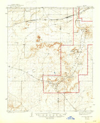
Petrified Forest National Monument dominates the high desert landscape of eastern Arizona in this 1910 survey, showing the protected area before modern highway development. The Atchison Topeka and Santa Fe RR skirts the northern edge of the park, providing the primary access point at the settlement of Adamana, where travelers once departed for tours of the fossilized wood deposits. The map captures the early 20th-century division of the monument into distinct sections like the First Forest, Second Forest, and Rainbow Forest, interspersed with dramatic geological formations such as The Battleship and The Flattops.
Find a feature on this map
34 named features on this map. Tap any name to fly to it.
Don’t see what you’re looking for? This feature index may not catch every label — zoom into the map to look around manually.
Map Details
Editions of this 1912 Petrified Forest Map
2 editions found
Other maps of this area

1883 · Tusayan
USGS Topo · 1:250,000

1886 · St Johns
USGS Topo · 1:250,000

1886 · Tusayan
USGS Topo · 1:250,000

1886 · Fort Defiance
USGS Topo · 1:250,000

1886 · Holbrook
USGS Topo · 1:250,000

1892 · Fort Defiance
USGS Topo · 1:250,000

1892 · St Johns
USGS Topo · 1:250,000

1893 · Holbrook
USGS Topo · 1:250,000

1947 · Flagstaff
USGS Topo · 1:250,000

1954 · Flagstaff
USGS Topo · 1:250,000