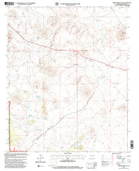
1990s Maps of Apache County, Arizona
Explore 41 historic maps of Apache County from the 1990s. These maps offer a rare glimpse into what life looked like during the 1990s — showing old roads, neighborhoods, homes, and landmarks that have changed or disappeared over time.
Whether you're researching your family's past, planning a metal detecting trip, or studying how Apache County's landscape evolved across the 1990s, these high-resolution maps are a powerful tool for exploring the history of this region.
- Focus on a specific era: All maps on this page are from the 1990s, giving you a focused view of this time period.
- See what’s changed: Compare century-old streets, trails, and buildings to today's modern landscape using overlays and satellite layers.
- Research with precision: Use these maps for genealogy, historical research, land use analysis, or educational projects.
- View, download, or print: Maps are fully viewable online in high resolution, and can be downloaded or printed for your own records.
Start exploring Apache County's history through authentic maps from the 1990s. This is your window into the past.
Apache County, AZ maps
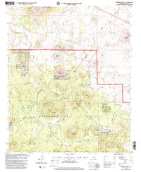
(41)- 1990 Map of Low Mountain, 1991 Print
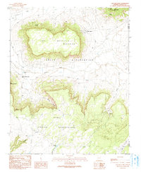 1990 Low Mountain1991 Print · USGSThe Navajo and Hopi reservations meet in the high desert of Navajo County during the late twentieth century. Researchers can trace land use through water features like Tse Chizzi Spring and high-altitude landmarks including Smoke Signal Point.
 - 1990 Map of Tsin Naan Tee, 1991 Print
 1990 Tsin Naan Tee1991 Print · USGSThe Navajo and Hopi nations meet in this high-desert plateau during the late twentieth century. Researchers can trace land use patterns through isolated features like Beshbito Wash, Tsin Naan Tee, and the Check Dams managing seasonal desert water.
 - 1991 Map of Rudd Knoll
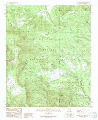
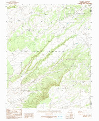
 1991 Rudd Knoll1991 Print · USGSApache County's high-country timber and ranching landscape is recorded here in the early nineties, centered on the Black River headwaters. Researchers can trace historic access points like Crosby Crossing, the remote Pat Knoll Cabin, and the area's extensive network of springs and reservoirs.
 - 1991 Map of Hannagan Meadow
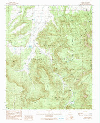
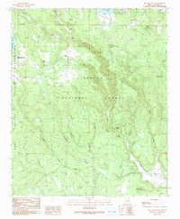
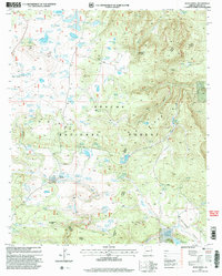
 1991 Hannagan Meadow1991 Print · USGSHigh-country meadows and Forest Service outposts define this corner of the White Mountains during the early nineties. Researchers can trace historic mountain routes and water sources like Hannagan Meadow, the Caldwell FS Station, and the remote Balke Cabin.2 unique versions available
 - 1991 Map of Nutrioso
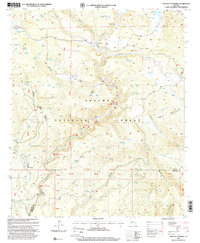
 1991 Nutrioso1991 Print · USGSThe high mountain valley around Nutrioso was a vital forest and ranching hub in the early 1990s. Researchers can locate remote family landmarks and burial sites like Maxwell Cem, Rogers Cemetery, and the high-elevation camps near Hulsey Lake.
 - 1991 Map of Escudilla Mountain
 1991 Escudilla Mountain1991 Print · USGSHigh-altitude wilderness and forest lands define the Arizona-New Mexico border in the 1990s. Researchers can trace remote alpine hydrology and landmarks from Profanity Ridge to the waters of Romero Lake and McFate Spring.
 - 1991 Map of Big Lake North
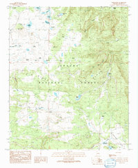
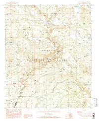
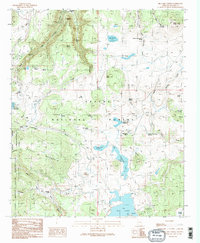 1991 Big Lake North1991 Print · USGSThe high timber and headwaters of the White Mountains are captured here in the early 1990s as a hub for ranching and recreation. Genealogists and researchers can trace family-named sites like Thompson Ranch and Phelps Cabin alongside the Railroad Grade.2 unique versions available
 - 1991 Map of Alpine
 1991 Alpine1991 Print · USGSAlpine and the surrounding high country are captured in this late-century survey, showcasing the remote mountain settlement and its ties to the Apache National Forest. Researchers can trace old family landmarks and civic sites like Campbell Flat, the Rodeo Ground, and Milk Ranch Spring.
 - 1991 Map of Luna Lake
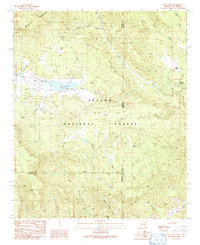 1991 Luna Lake1991 Print · USGSThe high-country borderlands of the Arizona and New Mexico line are documented here in the early 1990s. Local historians can trace the headwaters of the San Francisco River near Luna Lake and locate the small Cem and Double J Ranch.
 - 1991 Map of Big Lake South
 1991 Big Lake South1991 Print · USGSThe Apache National Forest in the early nineties reveals a landscape of high-country ranching and timber heritage. You can trace the Old RR Grade, locate the Reservation Ranch (Site), and find secluded springs like Colonel Spring.2 unique versions available
 - 1991 Map of Buffalo Crossing
 1991 Buffalo Crossing1991 Print · USGSIn the high-altitude woodlands of Eastern Arizona in the late eighties, the forest service managed a complex system of camps and river crossings. Genealogists and historians can trace the locations of Brentwood (Site), the Buffalo Crossing Footbridge, and the Clabber City settlement.
 - 1991 Map of Hoodoo Knoll
 1991 Hoodoo Knoll1991 Print · USGSEastern Arizona’s high country in the early nineties is defined here by the winding Black River and the high peaks of the Bear Wallow Wilderness. Researchers can trace remote routes like the Wallow Pack Trail and locate family-named landmarks such as McKibbins Pond.
 - 1991 Map of Lamb Well
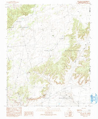
 1991 Lamb Well1991 Print · USGSThe high desert of Navajo and Apache counties comes into focus in the early 1990s, where tribal lands intersect. Trace the orientation of Antelope Mesa and find localized landmarks like Lamb Well, Keams, and the winding Jeddito Wash.
 - 1996 Map of McNary, 2003 Print
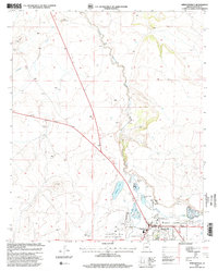
 1996 McNary2003 Print · USGSSoutheastern Arizona at the turn of the millennium shows a landscape shaped by water management and utility infrastructure. Trace the development of Mc Neal alongside its local Cemetery, Private Airport, and the meandering Whitewater Draw.
 - 1997 Map of Greens Peak, 2000 Print
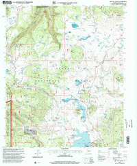
 1997 Greens Peak2000 Print · USGSHigh-altitude ranching and forest lands are captured here in the late 1990s, where the national forest meets tribal reservation lands. Researchers can locate legacy homesteads like Old Colter Ranch, trace the Udall Pipeline, and explore volcanic landmarks including Greens Peak and Soldier Butte.
 - 1997 Map of Big Lake North, 2000 Print
 1997 Big Lake North2000 Print · USGSThe high timber and grazing lands of the White Mountains are captured here in the late twentieth century. Researchers can trace the layout of the Thompson Ranch, find the secluded Voigt Cabin, and locate several remote tanks and springs like Horse Corral Spring.
 - 1997 Map of Hoodoo Knoll, 2000 Print
 1997 Hoodoo Knoll2000 Print · USGSGreenlee County high country is mapped here in the late nineties as it transitions from national forest to tribal reservation lands. Researchers can trace remote water sources and landmarks like McKibbins Pond, the Bear Wallow Wilderness, and Soldier Spring.
 - 1997 Map of Alpine, 2000 Print
 1997 Alpine2000 Print · USGSThe high-country community of Alpine thrived as a forestry and ranching hub in the late nineties. Local researchers can trace the development of the settlement through the Alpine Ranger Station, family-held lands like Noble Ranch, and the waters of Judd Lake.
 - 1997 Map of Hannagan Meadow, 2000 Print
 1997 Hannagan Meadow2000 Print · USGSThe high meadows and forest camps of the Arizona high country appear here in the late nineties, centered on the Coronado Trail. Researchers can trace old forest service outposts like Caldwell FS Station and the remote Balke Cabin or locate livestock landmarks like Willow Corral.
 - 1997 Map of Springerville, 2000 Print
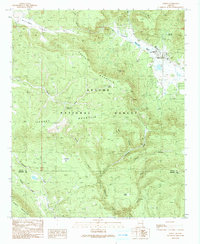
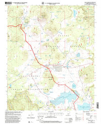
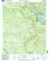
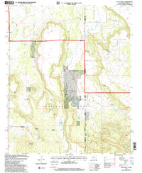
 1997 Springerville2000 Print · USGSEastern Arizona's high-country ranching and forest management are documented in this late-century revision of the Round Valley area. Researchers can trace the water rights and boundaries of Springerville through Becker Lake, the Voigt Ranch, and the Little Colorado River corridor.
 - 1997 Map of Whiting Knoll, 2000 Print
 1997 Whiting Knoll2000 Print · USGSHigh-country ranching and timber lands in the Apache National Forest were still being actively managed at the turn of the millennium. Genealogists and historians can locate family-named sites like the Whiting Homestead, Red Cabin, and Halls Ranch.
 - 1997 Map of Rudd Knoll, 2000 Print
 1997 Rudd Knoll2000 Print · USGSApache County's high-forest landscape is captured here in the late nineties, showing a region shaped by ranching and mountain water management. Researchers can locate remote markers like Pat Knoll Cabin and trace the complex system of mountain reservoirs including Saint Josephs Reservoir and Saint Marys Lake.
 - 1997 Map of Buffalo Crossing, 2000 Print
 1997 Buffalo Crossing2000 Print · USGSThe high country of the Apache National Forest is captured here in the late nineties, documenting a landscape of remote mountain outposts and forest water tanks. Researchers can trace historic access routes like the Ranger Trail and find isolated landmarks such as Clabber City and the Buffalo Crossing Footbridge.
 - 1997 Map of Loco Knoll, 2000 Print
 1997 Loco Knoll2000 Print · USGSThe Arizona and New Mexico borderlands come alive in the late nineties, showing a landscape of remote cattle operations and forest service districts. Researchers can trace the infrastructure of the H-V Ranch, from its Landing Strip to the waters of Pratt Lake.
 - 1997 Map of Springerville NW, 2000 Print
 1997 Springerville NW2000 Print · USGSApache County's volcanic highlands and national forest lands are documented here during the late twentieth century. Researchers can locate specific water sources and early industry sites like Schuster Spring, Cheney Lake, and several active Cinder Pits.
Showing maps 1-25 of 41
Top cities of Apache County
- Eagar historical maps
- St. Johns historical maps
- Springerville historical maps
- Dennehotso historical maps
- Alpine historical maps
Frequently asked questions
- What are the different types of historical maps available for Apache County?
- What is the oldest map of Apache County?
- Where can I purchase historical maps of Apache County for my home or office?
- Where can I download high-res historical maps of Apache County?
- Are there historical topographic maps available for Apache County?
- Is there historical aerial imagery available for Apache County?
- Where are historical maps of Apache County sourced from?