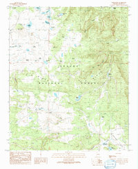
1991 Map of Rudd Knoll
USGS Topo · Published 1991About this map
Apache National Forest dominates this high-altitude landscape, where numerous water management features like Atcheson Reservoir, Saint Josephs Reservoir, and Rudd Reservoir illustrate the critical importance of water storage in eastern Arizona. The terrain is marked by prominent volcanic features such as Rudd Knoll and Pat Knoll, while the Black River is fed by the North Fork and East Fork near Crosby Crossing. The map reveals a specialized land use pattern including the Pat Knoll Cabin, a Cinder Pit, and scattered tanks and springs like Burk Tank and Miller Spring. These features, along with names like Riggs and the broad Williams Valley, document the grazing and forestry infrastructure of the White Mountains region during the late twentieth century.
Find a feature on this map
43 named features on this map. Tap any name to fly to it.
Don’t see what you’re looking for? This feature index may not catch every label — zoom into the map to look around manually.
Map Details
Editions of this 1991 Rudd Knoll Map
This is the sole edition of this map. No revisions or reprints were ever made.
Other maps of this area

1886 · St Johns
USGS Topo · 1:250,000

1892 · St Johns
USGS Topo · 1:250,000

1922 · Nutrioso
USGS Topo · 1:125,000

1954 · Clifton
USGS Topo · 1:250,000

1954 · Saint Johns
USGS Topo · 1:250,000

1957 · Clifton
USGS Topo · 1:250,000

1957 · Saint Johns
USGS Topo · 1:250,000

1958 · Clifton
USGS Topo · 1:250,000

1958 · Saint Johns
USGS Topo · 1:250,000

1958 · Alpine
USGS Topo · 1:62,500