1960s Maps of Apache County, Arizona
Explore 65 historic maps of Apache County from the 1960s. These maps offer a rare glimpse into what life looked like during the 1960s — showing old roads, neighborhoods, homes, and landmarks that have changed or disappeared over time.
Whether you're researching your family's past, planning a metal detecting trip, or studying how Apache County's landscape evolved across the 1960s, these high-resolution maps are a powerful tool for exploring the history of this region.
- Focus on a specific era: All maps on this page are from the 1960s, giving you a focused view of this time period.
- See what’s changed: Compare century-old streets, trails, and buildings to today's modern landscape using overlays and satellite layers.
- Research with precision: Use these maps for genealogy, historical research, land use analysis, or educational projects.
- View, download, or print: Maps are fully viewable online in high resolution, and can be downloaded or printed for your own records.
Start exploring Apache County's history through authentic maps from the 1960s. This is your window into the past.
Apache County, AZ maps
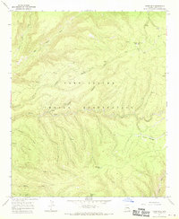
(65)- 1960 Map of Flagstaff
 1960 Flagstaff1960 Print · USGSNorthern Arizona at the dawn of the sixties shows a landscape defined by mesa-top Hopi villages and the burgeoning railroad hub of Flagstaff. Trace the path of U.S. 66 past Meteor Crater or locate historic trading posts like Gray Mountain Trading Post.2 unique versions available
 - 1961 Map of Marble Canyon
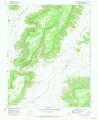
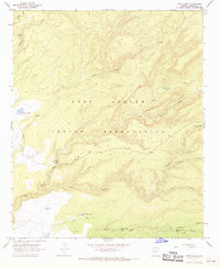
 1961 Marble Canyon1961 Print · USGSThe northern Arizona desert in the early sixties reveals a landscape of tribal lands and canyon crossings. Trace the old river life at Lees Ferry, find the Uranium mill at Tuba City, and locate the iconic Elephant Feet landmarks.
 - 1961 Map of McNary, 1963 Print
 1961 McNary1963 Print · USGSThe high country of Apache and Navajo Counties comes into focus during the early sixties, showing the vital intersection of the timber industry and emerging lakeside communities. Researchers can trace family sites near Lakeside Cem, the remote Indian Pine settlement, and several Cinder Pits along the Mogollon Rim.2 unique versions available
 - 1962 Map of Flagstaff
 1962 Flagstaff1962 Print · USGSNorthern Arizona in the early sixties showcases the intersection of Tribal lands, national forests, and the busy Route 66 corridor. Trace historic roadside stops and landmarks like Meteor Crater, the Buck-Rodgers Trading Post, and the ancient village of Old Oraibi.
 - 1962 Map of Gallup
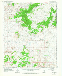
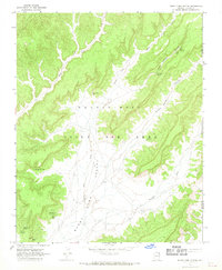
 1962 Gallup1962 Print · USGSThe high plateau and mountains surrounding Gallup in the early sixties reveal a landscape defined by tribal lands, coal mining, and the rail corridor. Researchers can locate remote trading posts, the Gibson Coal Mine, and the historic Window Rock capital.
 - 1962 Map of Clifton
 1962 Clifton1962 Print · USGSThe copper-rich Arizona-New Mexico borderlands come into focus in the early sixties, centered on the mining complexes of Morenci and Clifton. Researchers can trace the Southern Pacific rail lines and locate remote outposts like Honeymoon and the Double Circle Ranch.
 - 1962 Map of Saint Johns
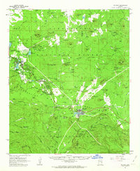
 1962 Saint Johns1962 Print · USGSEastern Arizona and the New Mexico borderlands come alive in the early sixties, showing a landscape of high-plateau ranching and early national monuments. Trace the path of the Atchison Topeka and Santa Fe or locate old water sources like Salado Springs and Lyman Reservoir.
 - 1966 Map of White Cone, 1968 Print
 1966 White Cone1968 Print · USGSThe high desert of northeastern Arizona is revealed here in the 1960s, showing the intersection of tribal lands and distinctive volcanic topography. Researchers can locate vital desert water sources like Sand Spring and trace the profiles of Tesihim Butte and Deshgish Butte.
 - 1966 Map of Keams Canyon, 1968 Print
 1966 Keams Canyon1968 Print · USGSThe Hopi and Navajo tribal lands in the mid-1960s reveal a landscape of ancestral sites and high-desert outposts. Researchers can locate remote settlements like Low Mountain alongside historical points like the Kit Carson Inscription Picnic Area and Jeddito.
 - 1966 Map of Hawley Lake West, 1971 Print
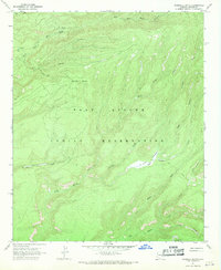
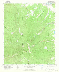
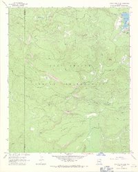 1966 Hawley Lake West1971 Print · USGSThe Fort Apache Indian Reservation comes into focus during the mid-sixties, revealing a landscape of mountain peaks and remote water tanks. Researchers can trace historic access routes like the Log Road and Pack Trail to landmarks such as McKays Peak and Hawley Lake.
 - 1967 Map of Gallup
 1967 Gallup1967 Print · USGSThe high desert of New Mexico and Arizona comes into focus in the mid-1960s, centered on the railroad and ranching hub of Gallup. Genealogists and historians can trace routes through Zuni Pueblo, identify old rail stops like Houck, or locate the Aqua Fria Post Office.
 - 1967 Map of Whippoorwill Spring, 1969 Print
 1967 Whippoorwill Spring1969 Print · USGSHigh desert mesas and traditional grazing lands characterize this Navajo-Hopi borderland in the late sixties. Genealogists and historians can trace essential desert water sources and local landmarks like Whippoorwill Sch, Burnt Corn, and Set Betoh.2 unique versions available
 - 1967 Map of Burnt Corn Spring, 1969 Print
 1967 Burnt Corn Spring1969 Print · USGSThe Navajo-Hopi Joint Use Area of northeastern Arizona is documented here in the late sixties, showing a landscape defined by seasonal washes and remote outposts. Researchers can locate critical water sources like Salt Water Spring and trace the small settlement of Burnt Corn.2 unique versions available
 - 1967 Map of Marshall Butte, 1970 Print
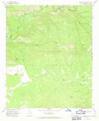
 1967 Marshall Butte1970 Print · USGSThe high canyons and drainages of the Fort Apache Indian Reservation are captured here in the late sixties. Researchers can trace remote backcountry routes including a JEEP TRAIL and PACK TRAIL near Marshall Butte and Lofer Cienega.
 - 1967 Map of Freezeout Mountain, 1970 Print
 1967 Freezeout Mountain1970 Print · USGSThe high plateau country of the San Carlos and Fort Apache reservations is documented here in the late sixties. Trace the water sources essential for high-country ranching, from Black River to Malay Tank and Loafer Tank.2 unique versions available
 - 1967 Map of Corn Creek Plateau, 1970 Print
 1967 Corn Creek Plateau1970 Print · USGSThe Fort Apache Indian Reservation is captured in the late sixties, showing the high-elevation landscape between the White River and the Turkey Creek drainages. Trace the rugged terrain from Geronimo Cave across the Sevenmile Rim to the remote Rock Creek Station.
 - 1967 Map of Sawbuck Mtn., 1970 Print
 1967 Sawbuck Mtn.1970 Print · USGSThe high plateau and river canyons of eastern Arizona are captured here in the late sixties, where the Apache and Graham county lines meet. Researchers can trace remote water infrastructure and mountain landmarks like Sawbuck Mtn, Point of Pines, and the Black River.
 - 1967 Map of Maverick SW, 1970 Print
 1967 Maverick SW1970 Print · USGSThe Black River canyon country comes into focus in the mid-1960s as a remote boundary between tribal lands. Researchers can trace the Reservation Boundary and find isolated landmarks like the Ten of Diamonds Ranch and the Lookout Tower on Maverick Mtn.
 - 1967 Map of West Poker Mtn., 1970 Print
 1967 West Poker Mtn.1970 Print · USGSThe Black River gorge serves as the primary landmark in the late 1960s, dividing the Fort Apache and San Carlos Indian Reservations. Researchers can trace remote trails and watering points like Hoot Owl Tank and Johnson Corral Tank across the Natanes Plateau.
 - 1967 Map of Bonito Rock, 1970 Print
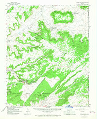
 1967 Bonito Rock1970 Print · USGSApache County's high-elevation ranching and timber landscapes are captured here in the late sixties. Researchers can trace the Old Railroad Grade, locate the remote Duke Ranch, and identify numerous alpine meadows like Race Horse Cienega.
 - 1967 Map of Odart Mtn, 1970 Print
 1967 Odart Mtn1970 Print · USGSThe high canyons of the White Mountains are documented here during the late sixties, showing the remote high-country terrain of the Fort Apache Indian Reservation. Researchers can locate the Lookout Tower atop Odart Mtn and trace the paths of Big Bonito Creek and the southern Jeep Trail.
 - 1967 Map of Elwood Canyon, 1970 Print
 1967 Elwood Canyon1970 Print · USGSGraham County ranching and tribal lands are captured here in the late sixties, where the Black River divides two reservations. Researchers can trace remote water sources like Elwood Windmill and navigate the high terrain of the San Carlos Plateau.
 - 1967 Map of Corn Creek, 1970 Print
 1967 Corn Creek1970 Print · USGSThe Fort Apache Indian Reservation is captured here in the late sixties, showing a landscape defined by ranching and remote mountain drainages. Researchers can locate family landmarks and water sources like the KL Ranch, the John Hall Cabin, and Upper Corn Creek Tank.
 - 1967 Map of Hawley Lake East, 1971 Print
 1967 Hawley Lake East1971 Print · USGSThe Fort Apache Indian Reservation is captured here in the late 1960s, showing a landscape of high-country lakes and peaks. Researchers can trace the water systems of Hawley Lake and Christmas Tree Lake or locate high points like Tiger Butte and Apache Butte.
 - 1967 Map of Mount Ord, 1971 Print
 1967 Mount Ord1971 Print · USGSThe high peaks of the White Mountains are captured here in the late sixties at the boundary of the Fort Apache Indian Reservation. Researchers can trace old mountain outposts like Slade Ranch and Darnall Cabin or explore the many alpine meadows including Purcell and Bonito Cienega.
Showing maps 1-25 of 65
Top cities of Apache County
- Eagar historical maps
- St. Johns historical maps
- Springerville historical maps
- Dennehotso historical maps
- Alpine historical maps
Frequently asked questions
- What are the different types of historical maps available for Apache County?
- What is the oldest map of Apache County?
- Where can I purchase historical maps of Apache County for my home or office?
- Where can I download high-res historical maps of Apache County?
- Are there historical topographic maps available for Apache County?
- Is there historical aerial imagery available for Apache County?
- Where are historical maps of Apache County sourced from?