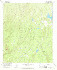
1967 Map of Bonito Rock
USGS Topo · Published 1970About this map
Fort Apache Indian Reservation high country is documented here during the late 1960s, showing a landscape defined by an intricate network of alpine creeks and sprawling cienegas. Isolated outposts such as Duke Ranch and Reservation Ranch anchor the human presence in this high-elevation terrain, while the hydrologic importance of the area is clear from the many named drainages including Bonito Creek, Hurricane Creek, and Pacheta Creek.
Find a feature on this map
33 named features on this map. Tap any name to fly to it.
Don’t see what you’re looking for? This feature index may not catch every label — zoom into the map to look around manually.
Map Details
Editions of this 1967 Bonito Rock Map
This is the sole edition of this map. No revisions or reprints were ever made.
Other maps of this area

1922 · Nutrioso
USGS Topo · 1:125,000

1954 · Clifton
USGS Topo · 1:250,000

1957 · Clifton
USGS Topo · 1:250,000

1958 · Clifton
USGS Topo · 1:250,000

1958 · Hannagan Meadow
USGS Topo · 1:62,500

1958 · Big Lake
USGS Topo · 1:62,500

1962 · Clifton
USGS Topo · 1:250,000

1967 · Marshall Butte
USGS Topo · 1:24,000

1967 · Odart Mtn
USGS Topo · 1:24,000
1967 · Hawley Lake East
USGS Topo · 1:24,000