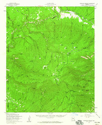
1958 Map of Hannagan Meadow
USGS Topo · Published 1960About this map
The Mogollon Rim dominates this high-altitude landscape of eastern Arizona, where the Apache National Forest meets the borders of the Fort Apache Indian Reservation and San Carlos Indian Reservation. The survey centers on the isolated settlement of Hannagan Meadow, featuring the Hannagan Meadow Ranger Station and nearby recreation sites like the KP Cienega Campground. The transport network of the late 1950s is defined by the winding Coronado Trail and numerous rugged routes including the Warren Trail and various unnamed Jeep Trails. Significant topographical landmarks used for navigation and observation include Reno Lookout and Blue Lookout. The complex drainage system is mapped in detail, showing the headwaters of the Black River and the many draws and ciénegas, such as Double Cienega, that characterize this forested plateau.
Find a feature on this map
85 named features on this map. Tap any name to fly to it.
Don’t see what you’re looking for? This feature index may not catch every label — zoom into the map to look around manually.
Map Details
Editions of this 1958 Hannagan Meadow Map
2 editions found

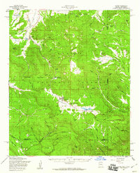
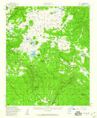
Other maps of this area

1913 · Morenci
USGS Topo · 1:125,000

1915 · Morenci
USGS Topo · 1:125,000

1922 · Nutrioso
USGS Topo · 1:125,000

1954 · Clifton
USGS Topo · 1:250,000

1957 · Clifton
USGS Topo · 1:250,000

1958 · Clifton
USGS Topo · 1:250,000
1958 · Alpine
USGS Topo · 1:62,500
1958 · Big Lake
USGS Topo · 1:62,500

1961 · Blue
USGS Topo · 1:62,500

1962 · Clifton
USGS Topo · 1:250,000