
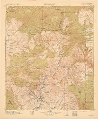
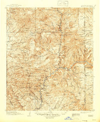
1915 Map of Morenci
USGS Topo · Published 1915About this map
Clifton and Morenci serve as the primary hubs of this mountain landscape at the height of early twentieth-century mining operations. The rugged topography is defined by significant copper mining interests, most notably at Copper King Mtn and Markeen Mtn, supported by the infrastructure of the Arizona Southern RR. The map illustrates a network of remote cattle operations and homesteads, including Browns Ranch, Cooks Ranch, and Lop Ear Ranch, which were scattered across the mesas and canyons before modern development reached the region. High-altitude outposts such as the Honeymoon Ranger Station and Metcalf Ranger Station oversee the transition into the Apache National Forest and Datil National Forest, marking the early administration of these public lands near the Arizona-New Mexico border.
Find a feature on this map
151 named features on this map. Tap any name to fly to it.
Don’t see what you’re looking for? This feature index may not catch every label — zoom into the map to look around manually.
Map Details
Editions of this 1915 Morenci Map
3 editions found
Other maps of this area
1902 · Clifton
USGS Topo · 1:62,500

1910 · Mogollon
USGS Topo · 1:125,000

1912 · Mogollon
USGS Topo · 1:125,000

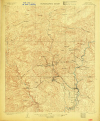
1913 · Morenci
USGS Topo · 1:125,000

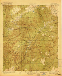
1915 · Reserve
USGS Topo · 1:125,000
1918 · Reserve
USGS Topo · 1:125,000

1922 · Nutrioso
USGS Topo · 1:125,000

1954 · Silver City
USGS Topo · 1:250,000

1954 · Clifton
USGS Topo · 1:250,000

1957 · Clifton
USGS Topo · 1:250,000