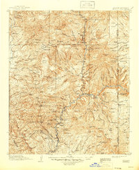
1915 Map of Morenci
USGS Topo · Published 1946About this map
The Apache National Forest landscape near the Arizona-New Mexico border is defined by a complex network of canyons and high mesas during the early twentieth century. This area, largely centered on Greenlee County, features an established ranching economy evidenced by the Double Circle Ranch, Chitty Ranch, and Laney Ranch dispersed throughout the rugged terrain. Industrial and administrative infrastructure is visible through the presence of the Arizona Southern RR and the Copper King Mine in the southern reaches of the quadrangle.
Find a feature on this map
158 named features on this map. Tap any name to fly to it.
Don’t see what you’re looking for? This feature index may not catch every label — zoom into the map to look around manually.
Map Details
Editions of this 1915 Morenci Map
3 editions found
Other maps of this area

1902 · Clifton
USGS Topo · 1:62,500

1910 · Mogollon
USGS Topo · 1:125,000

1912 · Mogollon
USGS Topo · 1:125,000

1913 · Morenci
USGS Topo · 1:125,000

1915 · Morenci
USGS Topo · 1:125,000

1915 · Reserve
USGS Topo · 1:125,000

1918 · Reserve
USGS Topo · 1:125,000

1922 · Nutrioso
USGS Topo · 1:125,000

1954 · Silver City
USGS Topo · 1:250,000

1954 · Clifton
USGS Topo · 1:250,000