Old Maps of Greenlee County, Arizona
Explore 278 old maps of Greenlee County, spanning from 1902 to today. These high-resolution historic maps reveal how streets, neighborhoods, landmarks, and natural features evolved over time — perfect for genealogy, metal detecting, research, and local history exploration.
What you can do with these maps:
- See how Greenlee County changed over time: Compare historical maps to modern-day views to trace roads, homesites, rail lines & more.
- View detailed metadata: Each map includes creators, publishers, year, scale, and archive source.
- Overlay maps with satellite & LiDAR: Visualize the past alongside modern tools to explore terrain & human change.
- Trusted historical sources: Maps sourced from the USGS, Library of Congress, and other archives.
- Access maps your way: View online, download high-res files, or order prints for personal or research use.
Start exploring old maps of Greenlee County to uncover forgotten places, hidden landmarks, and the deep history beneath your feet.
Greenlee County, AZ maps
(278)- 1902 Map of Clifton
 1902 Clifton1902 Print · USGSMining and rail history converge in this 1902 portrait of the Arizona Territory's copper belt. Researchers can trace the industrial layout of Morenci and Clifton, identifying the routes of the Coronado RR and the specialized King Incline.3 unique versions available
 - 1913 Map of Morenci, 1954 Print
 1913 Morenci1954 Print · USGSArizona's copper country and high timberlands meet in this pre-war survey of the Morenci district and Apache National Forest. Researchers can trace the early industrial footprint of Morenci and Clifton or find family landmarks like Miller Cabin and Cooks Ranch.2 unique versions available
 - 1915 Map of Morenci
 1915 Morenci1915 Print · USGSGreenlee County during the early 1900s shows a landscape defined by industrial copper mining and isolated high-desert ranching. Genealogists and historians can trace family locations from the Eagle Creek School to historic homesteads like Dudley Ranch and the settlement of Oroville.3 unique versions available
 - 1917 Map of San Simon
 1917 San Simon1917 Print · USGSArizona and New Mexico ranching and rail history meet here during the years following the border surveys. Genealogists and historians can locate remote family sites like Posey Ranch, the historical Old Fort Bowie, and early copper or granite works at Willie Rose Mine.3 unique versions available
 - 1922 Map of Nutrioso
 1922 Nutrioso1922 Print · USGSHigh-altitude ranching and forest service outposts define the Arizona-New Mexico border in the early twenties. Researchers can trace remote family landmarks like Reservation Ranch and Colter's Res. or locate early settlements at Nutrioso and Alpine.
 - 1926 Map of Orange Butte
 1926 Orange Butte1926 Print · USGSCochise County's desert frontier comes into sharp focus during the mid-twenties, tracing the borderlands from the Peloncillo Mountains to the Animas Valley. Researchers can locate dozens of family-named landmarks like Lyall Ranch and Chamberlin Ranch, alongside working claims at Volcano Mine.
 - 1950 Map of San Simon
 1950 San Simon1950 Print · USGSThe high desert borderlands of Arizona and New Mexico are captured here at mid-century, following the line of the Southern Pacific railroad. Researchers can locate remote cattle operations and early landmarks like the Braidfoot Ranch, the Old Stage Station (Ruins), and the lonely Giddings Grave.2 unique versions available
 - 1951 Map of San Simon
 1951 San Simon1951 Print · USGSCrossing the Arizona-New Mexico border in the 1950s, this survey shows a high-desert landscape defined by the railroad and mountain passes. Trace the legacy of early travel and mining at the Old Stage Station (Ruins), Giddings Grave, and the Volcano Mine.
 - 1954 Map of Silver City, 1967 Print
 1954 Silver City1967 Print · USGSSoutheast Arizona and southwest New Mexico meet in this mid-century survey of the high desert and mountain mining districts. Local researchers can trace the rail lines through Lordsburg, the silver operations at Ash Peak Mines, and the limits of Fort Bayard Military Reservation.4 unique versions available
 - 1954 Map of Clifton, 1968 Print
 1954 Clifton1968 Print · USGSThe high timber and copper country of the Arizona-New Mexico border is captured here during the mid-fifties. Genealogists and historians can trace family holdings like the Double Circle Ranch or study the industrial footprint of the Smelting Plant at Clifton.3 unique versions available
 - 1957 Map of Clifton
 1957 Clifton1957 Print · USGSThe copper-mining district around Clifton and Morenci meets the high timberlands of the Mogollon Rim during the mid-1950s. Genealogists and researchers can trace family-named outposts and remote mountain settlements like Reserve, Stargo, and Fort Thomas.
 - 1958 Map of Silver City
 1958 Silver City1958 Print · USGSSouthwestern New Mexico and eastern Arizona appear here in the mid-1950s, a period of intensive mining and rail activity. Trace the routes of the Southern Pacific RR through Lordsburg or locate historic operations at the Chino Mine and Santa Rita.
 - 1958 Map of Clifton
 1958 Clifton1958 Print · USGSThe rugged high country of the Arizona-New Mexico border comes into focus in the mid-fifties, showing a landscape of mining camps and forest outposts. Genealogists and researchers can trace old settlements and remote sites like Mogollon, East Fork Mission, and the Tidwell Mine.
 - 1958 Map of Alpine, 1960 Print
 1958 Alpine1960 Print · USGSThe high country of the Arizona-New Mexico border is captured here during the late fifties, showing a landscape defined by timber, ranching, and remote forest outposts. Genealogists and historians can locate specific sites like the Alpine Timber Camp, the White Mountain Boys Ranch, and old mountain springs such as Whitetail Spring.3 unique versions available
 - 1958 Map of Hannagan Meadow, 1960 Print
 1958 Hannagan Meadow1960 Print · USGSHigh atop the eastern Arizona plateau in the late fifties, this survey captures the remote outposts along the Coronado Trail. Researchers can trace the early Forest Service presence at Hannagan Meadow Ranger Station or locate family-named landmarks like Baldy Bill Point and Hoodoo Knoll.2 unique versions available
 - 1958 Map of Big Lake, 1960 Print
 1958 Big Lake1960 Print · USGSApache County's high-country ranching and forest lands are captured here in the late fifties. Researchers can trace historic family holdings like Voigt Ranch or locate remote outposts such as Pat Knoll Guard Sta and Reservation Ranch.4 unique versions available
 - 1959 Map of York Valley, 1961 Print
 1959 York Valley1961 Print · USGSThe Gila River valley in the late fifties was a remote corridor of rail transport and ranching along the Arizona-New Mexico line. Genealogists and historians can trace the family names behind Willis Ranch and Smith Ranch or locate the site of the old Tollhouse and Petroglyphs.3 unique versions available
 - 1960 Map of Guthrie, 1961 Print
 1960 Guthrie1961 Print · USGSGraham County ranching and mining come into sharp focus in the early sixties at the confluence of the Gila River and San Francisco River. Researchers can trace the Southern Pacific rail line to Guthrie and locate remote sites like the Ash Peak Mine and Gillespie Ranch.2 unique versions available
 - 1960 Map of Duncan, 1961 Print
 1960 Duncan1961 Print · USGSThe Gila River valley along the Arizona-New Mexico border is captured here in the early 1960s as a thriving corridor of rail and irrigation. Researchers can trace the Southern Pacific line through Duncan and Franklin, or locate family sites like Cox Ranch and Rainville Ranch.4 unique versions available
 - 1961 Map of Blue, 1963 Print
 1961 Blue1963 Print · USGSThe high Mogollon Rim and the Arizona-New Mexico state line meet in the early 1960s, showing a remote mountain landscape. Researchers can trace historic forest outposts and ranch sites like Blue Ranger Sta, Carlton Vista, and the settlement of Blue.2 unique versions available
 - 1962 Map of Silver City
 1962 Silver City1962 Print · USGSThe high desert borderlands of New Mexico and Arizona come alive in this early sixties survey. Genealogists and historians can trace the mining economy through the Chino Mine, follow the rail routes of the Southern Pacific, or locate settlements like Virden and Bayard.
 - 1962 Map of Clifton
 1962 Clifton1962 Print · USGSThe copper-rich Arizona-New Mexico borderlands come into focus in the early sixties, centered on the mining complexes of Morenci and Clifton. Researchers can trace the Southern Pacific rail lines and locate remote outposts like Honeymoon and the Double Circle Ranch.
 - 1962 Map of Clifton, 1964 Print
 1962 Clifton1964 Print · USGSMining and industry define this corner of Greenlee County in the early sixties, as the copper economy reshaped the Arizona landscape. Genealogists and historians can trace company housing at Plantsite, the massive Morenci Open Pit, and the former town of Metcalf.2 unique versions available
 - 1962 Map of Big Lue Mts, 1964 Print
 1962 Big Lue Mts1964 Print · USGSThe Arizona and New Mexico borderlands come to life in this early 1960s survey of the high mesas and deep river canyons. Genealogists and researchers can trace isolated homesteads like Martinez Ranch and historic landmarks like the Cliff Dwelling or Black Jack Cave.2 unique versions available
 - 1962 Map of San Simon, 1971 Print
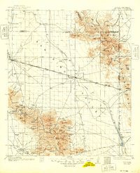 1962 San Simon1971 Print · USGSThe Arizona-New Mexico borderlands come alive in this survey of the San Simon Valley and the Peloncillo Mountains as they appeared before the Great War. Genealogists and historians can trace the foundations of Old Fort Bowie, the SOUTHERN PACIFIC line, and family landmarks like Riggs Home Ranch.
Showing maps 1-25 of 278
Top cities of Greenlee County
Frequently asked questions
- What are the different types of historical maps available for Greenlee County?
- What is the oldest map of Greenlee County?
- Where can I purchase historical maps of Greenlee County for my home or office?
- Where can I download high-res historical maps of Greenlee County?
- Are there historical topographic maps available for Greenlee County?
- Is there historical aerial imagery available for Greenlee County?
- Where are historical maps of Greenlee County sourced from?