2020s Maps of Greenlee County, Arizona
Explore 49 historic maps of Greenlee County from the 2020s. These maps offer a rare glimpse into what life looked like during the 2020s — showing old roads, neighborhoods, homes, and landmarks that have changed or disappeared over time.
Whether you're researching your family's past, planning a metal detecting trip, or studying how Greenlee County's landscape evolved across the 2020s, these high-resolution maps are a powerful tool for exploring the history of this region.
- Focus on a specific era: All maps on this page are from the 2020s, giving you a focused view of this time period.
- See what’s changed: Compare century-old streets, trails, and buildings to today's modern landscape using overlays and satellite layers.
- Research with precision: Use these maps for genealogy, historical research, land use analysis, or educational projects.
- View, download, or print: Maps are fully viewable online in high resolution, and can be downloaded or printed for your own records.
Start exploring Greenlee County's history through authentic maps from the 2020s. This is your window into the past.
Greenlee County, AZ maps
(49)- 2020 Map of Harden Cienega, 2020 Print
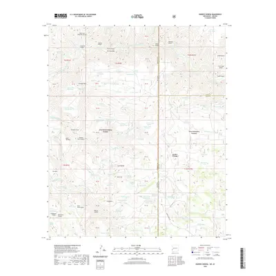 2020 Harden Cienega2020 Print · USGSCovers Greenlee County, including Harden Cienega, Grant County, and other nearby areas
 - 2020 Map of Tillie Hall Peak, 2020 Print
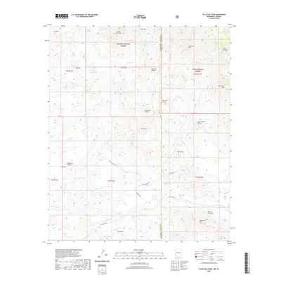 2020 Tillie Hall Peak2020 Print · USGSCovers Greenlee County, including Grant County, United States, and other nearby areas
 - 2020 Map of Goat Camp Spring, 2020 Print
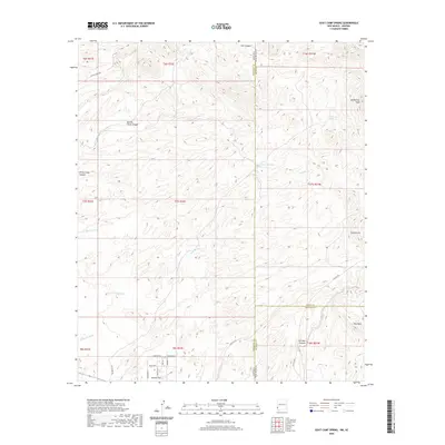 2020 Goat Camp Spring2020 Print · USGSCovers Greenlee County, including Duncan, Grant County, and other nearby areas
 - 2021 Map of Duncan, 2021 Print
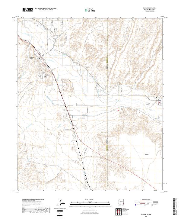 2021 Duncan2021 Print · USGSThe Arizona-New Mexico border comes into focus in the early 2020s, highlighting the shared river-valley economy of Duncan and Virden. Local researchers can trace family landmarks and irrigation history through the New Model Canal and the Duncan Valley Cem.
 - 2021 Map of Sheldon, 2021 Print
 2021 Sheldon2021 Print · USGSArizona's Gila River valley remains a critical corridor for small settlements like Apache Grove and Sheldon in this modern topographic study. Researchers can trace the drainage patterns of family-named landmarks like Wes White Canyon and Harris Camp Canyon.
 - 2021 Map of Hot Well, 2021 Print
 2021 Hot Well2021 Print · USGSThe high desert of southeastern Arizona in the early twenty-first century is captured here along the Graham and Greenlee county line. Researchers can trace the drainage of the Gila River and locate remote landmarks like Indian Rocks, Flat Top, and the Hot Well settlement.
 - 2021 Map of Orange Butte, 2021 Print
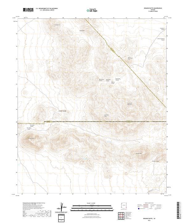 2021 Orange Butte2021 Print · USGSSoutheast Arizona’s high desert comes into focus at this tri-county intersection during the early twenty-first century. Researchers can trace remote water sources like Tule Tank and Bear Sign Tank alongside landmarks like Orange Butte and San Simon Peak.
 - 2021 Map of York, 2021 Print
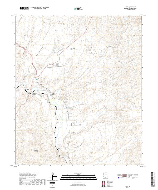 2021 York2021 Print · USGSEastern Arizona near the New Mexico border shows a landscape defined by the Gila River and high mesas during the early 2020s. Researchers can locate specific homestead routes and local landmarks like Three Way, the Greenlee County Airport, and York Valley.
 - 2021 Map of Fritz Canyon, 2021 Print
 2021 Fritz Canyon2021 Print · USGSGreenlee County highlands are documented here during the early twenty-first century as the Blue River passes through Apache National Forest. Researchers can trace old stock-water routes between Pat Mesa and Sunflower Saddle.
 - 2021 Map of Rose Peak, 2021 Print
 2021 Rose Peak2021 Print · USGSCovers Greenlee County, including United States, Arizona, and other nearby areas
 - 2021 Map of Hannagan Meadow, 2021 Print
 2021 Hannagan Meadow2021 Print · USGSThe high meadows and mountain canyons of Greenlee County are captured here in the early twenty-first century. Researchers can trace remote settlements and water sites like Hannagan Meadow, Sprucedale, and the numerous springs of Deep Cienega.
 - 2021 Map of Clifton, 2021 Print
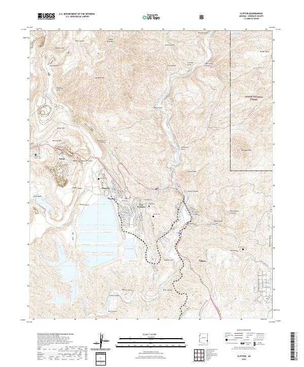 2021 Clifton2021 Print · USGSThe copper-rich peaks of Greenlee County appear in high detail during this modern survey of the Arizona mining belt. Genealogists and historians can trace the foundations of company towns and local heritage at Metcalf Cem, Stargo, and the Greenlee County Courthouse.
 - 2021 Map of Robinson Mesa, 2021 Print
 2021 Robinson Mesa2021 Print · USGSThe Apache National Forest landscape in the early 2020s shows a high-elevation wilderness defined by intricate trail systems and critical water catchments. Researchers can trace the Eagle National Recreation Trl or locate named landmarks like Robinson Spring and the Blackwater Pit Tank.
 - 2021 Map of Luna Lake, 2021 Print
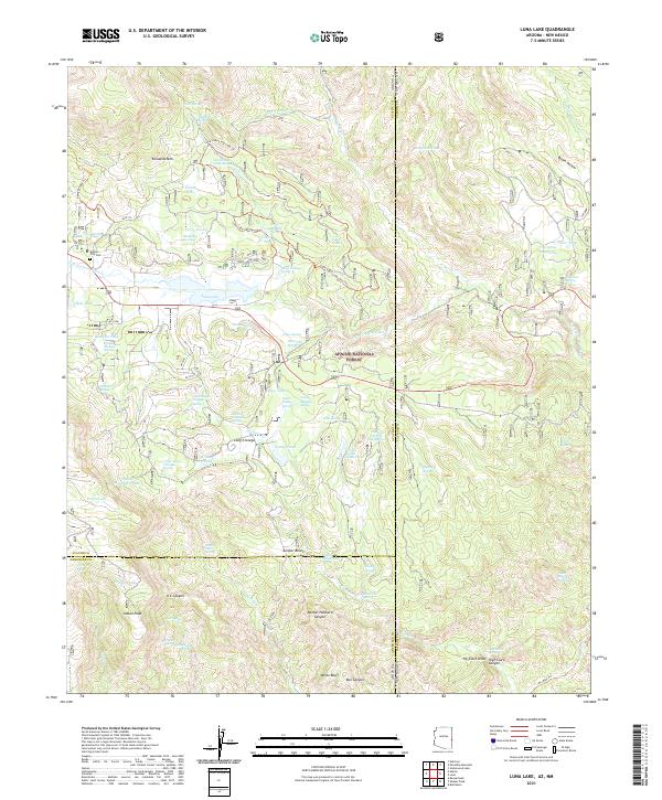 2021 Luna Lake2021 Print · USGSThe Arizona-New Mexico borderlands in the early 2020s are captured here, centered on the high-altitude waters of the Apache National Forest. Genealogists and hikers can trace family names and routes through Alpine City Cem, Escudilla Mtn, and the Luna Lake Long Loop Trl.
 - 2021 Map of Hoodoo Knoll, 2021 Print
 2021 Hoodoo Knoll2021 Print · USGSThis high-elevation reach of the Apache National Forest in eastern Arizona is shown here in the early 2020s as a landscape of deep canyons and seasonal water. Outdoorsmen and researchers can trace the intricate Black River Trl past landmarks like Hoodoo Knoll, Elk Lake, and Wildcat Point.
 - 2021 Map of Pipestem Mountain, 2021 Print
 2021 Pipestem Mountain2021 Print · USGSGreenlee County's high-country terrain is documented here in the early twenty-first century, showing the intricate water and trail systems of the Apache National Forest. Researchers can trace the ranching-era geography of Four Bar Mesa and locate named watering holes like Slaughter House Springs and Camp Stool Spring.
 - 2021 Map of Bear Mountain, 2021 Print
 2021 Bear Mountain2021 Print · USGSGreenlee County, Arizona, is shown in 2021 as a landscape of high mesas and canyon systems within the Apache National Forest. Researchers can trace old routes like the Old Sawmill Trail past landmarks such as Thomas Lake and the Ice Cream Cone.
 - 2021 Map of Alma Mesa, 2021 Print
 2021 Alma Mesa2021 Print · USGSThe Arizona and New Mexico borderlands come into focus in the early 2020s, showing a remote landscape of canyons and high mesas. Researchers can trace the intersections of the Apache National Forest and Gila National Forest while locating backcountry landmarks like Alma Mesa and Hannah Springs Cr.
 - 2021 Map of Maness Peak, 2021 Print
 2021 Maness Peak2021 Print · USGSThe Arizona and New Mexico borderlands come alive in the 2020s, revealing a landscape of remote peaks and high forest canyons. Researchers can trace historic paths like the Mother Hubbard Trl and locate local landmarks such as Blue Cem and Milligan Lake.
 - 2021 Map of Gila Box, 2021 Print
 2021 Gila Box2021 Print · USGSGraham County’s desert canyons and river confluences are documented here in detail during the early twenty-first century. Researchers can trace the rugged intersection of the Gila River and Bonita Creek or locate landmarks like Gila Box and Wire Corral Mesa.
 - 2021 Map of Coronado Mountain, 2021 Print
 2021 Coronado Mountain2021 Print · USGSThe high peaks of the Apache National Forest in Greenlee County come alive in this modern survey of the Arizona wilderness. Researchers can trace the trails and water sources that define this landscape, from the settlement of Granville to landmarks like Coronado Mtn and Wagon Spring.
 - 2021 Map of Dix Creek, 2021 Print
 2021 Dix Creek2021 Print · USGSEastern Arizona canyon country within the Apache National Forest comes to life in this recent topographic study. Researchers can trace remote water sources and trails through high-elevation terrain like Lone Tree Mesa, Blue River, and Hog Canyon.
 - 2021 Map of Maple Peak, 2021 Print
 2021 Maple Peak2021 Print · USGSThe Arizona-New Mexico border territory is captured here in the early twenty-first century, showing the rugged topography of the Apache and Gila National Forests. Researchers can trace remote routes like the Wildbunch Trl and Charlie Moore Trl past landmarks such as Maple Peak and Skeleton Canyon.
 - 2021 Map of Copperplate Gulch, 2021 Print
 2021 Copperplate Gulch2021 Print · USGSGreenlee County in the early 2020s remains a landscape of vertical extremes and deep canyons within the Apache National Forest. Researchers can trace the routes of the Coronado Trl past landmarks like Coronado Mtn, Copper Mtn, and the Coronado Incline.
 - 2021 Map of Rattlesnake Spring, 2021 Print
 2021 Rattlesnake Spring2021 Print · USGSGreenlee County's high-country terrain is captured here in the early 2020s, showcasing the intricate drainage systems of the Big Lue Mountains. You can trace historical routes like the Hickey Springs Trl and locate vital water sources such as Rattlesnake Spring and Buzzard Roost Tank.
Showing maps 1-25 of 49
Top cities of Greenlee County
Frequently asked questions
- What are the different types of historical maps available for Greenlee County?
- What is the oldest map of Greenlee County?
- Where can I purchase historical maps of Greenlee County for my home or office?
- Where can I download high-res historical maps of Greenlee County?
- Are there historical topographic maps available for Greenlee County?
- Is there historical aerial imagery available for Greenlee County?
- Where are historical maps of Greenlee County sourced from?