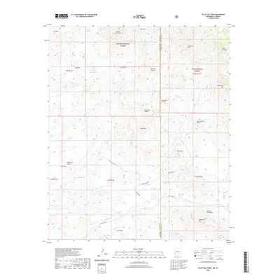
2020 Map of Tillie Hall Peak
USGS Topo · Published 2020About this map
Apache National Forest and Gila National Forest meet in this high-altitude landscape along the New Mexico-Arizona border. The terrain is defined by a series of prominent summits, including Tillie Hall Peak, Yellowjacket Peak, and Hells Hole Peak, while the drainage system of Apache Cr and its tributaries carve deep canyons like Hells Hole Canyon and Dark Thunder Canyon. This map provides a detailed view of the remote ranching infrastructure in Grant County during the early 21st century. Access across the rugged geography is marked by historic routes such as Stauffer Ranch Rd and Goodner Ranch Rd, which connect isolated water sources like Bitter Creek Spring and Franks Tank. The survey highlights the essential nature of these springs and tanks in a landscape where names like Hells Hole and Wampoo Wash reflect the challenging environmental conditions faced by generations of land users.
Find a feature on this map
55 named features on this map. Tap any name to fly to it.
Don’t see what you’re looking for? This feature index may not catch every label — zoom into the map to look around manually.
Map Details
Editions of this 2020 Tillie Hall Peak Map
This is the sole edition of this map. No revisions or reprints were ever made.
Other maps of this area

1910 · Mogollon
USGS Topo · 1:125,000

1912 · Mogollon
USGS Topo · 1:125,000

1913 · Morenci
USGS Topo · 1:125,000

1915 · Morenci
USGS Topo · 1:125,000

1954 · Silver City
USGS Topo · 1:250,000

1954 · Clifton
USGS Topo · 1:250,000

1957 · Clifton
USGS Topo · 1:250,000

1958 · Silver City
USGS Topo · 1:250,000

1958 · Clifton
USGS Topo · 1:250,000

1959 · Steeple Rock
USGS Topo · 1:62,500