1980s Maps of Greenlee County, Arizona
Explore 23 historic maps of Greenlee County from the 1980s. These maps offer a rare glimpse into what life looked like during the 1980s — showing old roads, neighborhoods, homes, and landmarks that have changed or disappeared over time.
Whether you're researching your family's past, planning a metal detecting trip, or studying how Greenlee County's landscape evolved across the 1980s, these high-resolution maps are a powerful tool for exploring the history of this region.
- Focus on a specific era: All maps on this page are from the 1980s, giving you a focused view of this time period.
- See what’s changed: Compare century-old streets, trails, and buildings to today's modern landscape using overlays and satellite layers.
- Research with precision: Use these maps for genealogy, historical research, land use analysis, or educational projects.
- View, download, or print: Maps are fully viewable online in high resolution, and can be downloaded or printed for your own records.
Start exploring Greenlee County's history through authentic maps from the 1980s. This is your window into the past.
Greenlee County, AZ maps
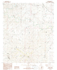
(23)- 1981 Map of Nutrioso, 1996 Print
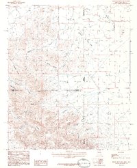
 1981 Nutrioso1996 Print · USGSEastern Arizona and the New Mexico borderlands are captured here in the early eighties, showcasing a vast expanse of national forest and tribal lands. Researchers can trace the high-country routes between Nutrioso, Alpine, and Whiteriver, or locate landmarks along the Mogollon Rim and Black River.2 unique versions available
 - 1985 Map of Gila Box, 1986 Print
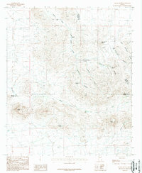
 1985 Gila Box1986 Print · USGSGraham and Greenlee counties in the mid-1980s showcase a high-desert landscape defined by the winding Gila River and remote canyon systems. Researchers can trace historic water catchments and ranching landmarks like Zorilla Tank, Wire Corral Mesa, and the Cinder Pit.
 - 1986 Map of Sheldon
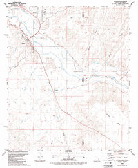
 1986 Sheldon1986 Print · USGSThe Gila River valley in the mid-1980s is captured here, showing the transit corridor through Greenlee County. Genealogists and historians can trace the Southern Pacific River rail line past Sheldon and the Ash Peak Mines.
 - 1986 Map of Guthrie
 1986 Guthrie1986 Print · USGSEastern Arizona’s river valleys and mining districts are captured here in the mid-1980s. Local historians can trace the Smuggler Open Pit Mine, find the Gillard Hot Springs along the Gila River, and locate family-named landmarks like Wilkerson Tank.2 unique versions available
 - 1986 Map of Ash Peak
 1986 Ash Peak1986 Print · USGSThe Graham and Greenlee county line near the Gila River valley is captured here in the mid-1980s. Researchers can locate mining artifacts near Ash Peak, including a Mine Shaft, and trace early transport routes through Tollgate Canyon.
 - 1986 Map of Duncan, 1987 Print
 1986 Duncan1987 Print · USGSIn the mid-1980s, the Gila River valley along the Arizona-New Mexico state line was a vital agricultural corridor shaped by rail and irrigation. Genealogists and local historians can trace the irrigation networks of the Sunset Canal and locate landmarks like the Cotton Gin and Cem near Duncan.2 unique versions available
 - 1986 Map of Clifton, 1987 Print
 1986 Clifton1987 Print · USGSArizona's copper country and the rugged borderlands come into sharp focus in the mid-1980s. Researchers can trace the massive Morenci Open Pit and its rail connections to Clifton, alongside remote outposts like Point of Pines and Fort Thomas.2 unique versions available
 - 1986 Map of Tillie Hall Peak, 1987 Print
 1986 Tillie Hall Peak1987 Print · USGSThe Arizona-New Mexico borderlands in the mid-1980s show a high-country landscape of national forests and isolated mountain peaks. Researchers can locate remote resource extractions like a Mine or Prospect and trace drainages from Hells Hole Canyon to Bitter Creek.
 - 1986 Map of Hot Well, 1987 Print
 1986 Hot Well1987 Print · USGSThe high desert basins of Greenlee and Graham counties are shown in the mid-eighties as a landscape of deep canyons and rail-linked river valleys. You can trace the Southern Pacific line along the Gila River and locate remote features like O'Connor Field and Hot Well.
 - 1986 Map of Whitlock Peak, 1987 Print
 1986 Whitlock Peak1987 Print · USGSSoutheast Arizona cattle country is captured here in the mid-1980s, centered on the high divide between Graham and Greenlee counties. Researchers can trace remote water sources and local landmarks such as Whitlock Peak, Old Camp Canyon, and Big Tank.
 - 1986 Map of Round Mountain, 1987 Print
 1986 Round Mountain1987 Print · USGSThe high desert borderlands of Arizona and New Mexico come alive in the mid-1980s, showcasing a landscape defined by ranching and rail. Trace the path of the Southern Pacific Railroad or locate water management sites like Horseshoe Terrace Dam and the Lazy B Ranch Landing Strip.
 - 1986 Map of York, 1987 Print
 1986 York1987 Print · USGSThe Gila River valley in the mid-1980s reveals a transition from river-bottom settlements to high mesas. Researchers can trace the Southern Pacific rail line through York and locate local landmarks like the Drive-in Theater and Three Way.
 - 1986 Map of Goat Camp Spring, 1987 Print
 1986 Goat Camp Spring1987 Print · USGSThe high desert along the Arizona-New Mexico border in the 1980s reveals a landscape of isolated mining claims and spring-fed camps. Researchers can trace historic activity at Goat Camp Spring, several scattered Mines, and the settlement at Hunter Flat.
 - 1987 Map of Engine Mountain
 1987 Engine Mountain1987 Print · USGSThe high desert borderlands of Arizona and New Mexico are captured in the late 1980s as ranching and mining shaped the landscape. Researchers can locate remote water sources like Rockhouse Spring and historical landmarks such as Engine Mountain and the isolated Millsite.
 - 1987 Map of Orange Butte
 1987 Orange Butte1987 Print · USGSThe high desert of Cochise and Graham counties is captured here in the late eighties as a landscape of remote ranching outposts. Trace the locations of isolated desert water sources and improvements like Old Camp Windmill, Tule Wells, and Indian Tanks.
 - 1989 Map of Big Lue Mountains
 1989 Big Lue Mountains1989 Print · USGSThe high borderlands of Arizona and New Mexico are captured here in the late 1980s, where federal forest lands converge. Researchers can trace historic water sources and rugged landmarks like Black Jack Spring, Palace Peak, and the Harden Cienega.
 - 1989 Map of Dix Creek, 1990 Print
 1989 Dix Creek1990 Print · USGSThe high desert of Greenlee County during the late eighties is defined here by the confluence of the San Francisco River and Blue River. Local historians and researchers can trace remote landmarks like Martinez Ranch, Harden Cienega, and numerous named springs such as Blue Holes Spring.
 - 1989 Map of Harden Cienega, 1990 Print
 1989 Harden Cienega1990 Print · USGSThe Arizona and New Mexico borderlands come alive in the late eighties, showing a landscape defined by forest boundaries and high mesas. Researchers can trace the winding Harden Cienega Road and locate remote water sources like Indian Cave Spring and Rock Spring.
 - 1989 Map of Clifton, 1990 Print
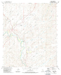
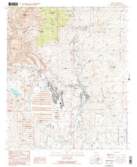 1989 Clifton1990 Print · USGSThe copper mining heart of Greenlee County comes alive in this late-century record of Clifton and the surrounding river canyons. Genealogists and researchers can trace old settlement sites and family history at Metcalf Cem and Bunkers Cem near the massive Morenci Pit.
 - 1989 Map of Copperplate Gulch, 1990 Print
 1989 Copperplate Gulch1990 Print · USGSMining operations in Greenlee County were in a period of significant expansion during the late eighties. Researchers can trace industrial infrastructure from the Old Railroad Grade to the Morenci Pit and the settlement at Trujillo.
 - 1989 Map of Rattlesnake Spring, 1990 Print
 1989 Rattlesnake Spring1990 Print · USGSGreenlee County’s high desert backcountry in the late eighties is defined here by the rugged boundaries of the Apache National Forest. Researchers and hikers can trace vital water sources like Rattlesnake Spring or navigate the high passes of Rattlesnake Gap and Sixshooter Gap.
 - 1989 Map of Mitchell Peak, 1990 Print
 1989 Mitchell Peak1990 Print · USGSGreenlee County, Arizona, was a rugged frontier of mining and water rights when this survey was updated in the late eighties. Researchers can trace the legacy of prospecting through numerous Mine Shafts and remote landmarks like Mitchell Peak and the San Francisco River.
 - 1989 Map of Coronado Mountain, 1990 Print
 1989 Coronado Mountain1990 Print · USGSGreenlee County high country is shown at the end of the eighties, straddling the San Carlos Indian Reservation line. Researchers can trace remote mining and water sites like the Crystal Cave Prospect, Sawmill Spring, and Willow Tank.
End of results
Showing maps 1-23 of 23
Top cities of Greenlee County
Frequently asked questions
- What are the different types of historical maps available for Greenlee County?
- What is the oldest map of Greenlee County?
- Where can I purchase historical maps of Greenlee County for my home or office?
- Where can I download high-res historical maps of Greenlee County?
- Are there historical topographic maps available for Greenlee County?
- Is there historical aerial imagery available for Greenlee County?
- Where are historical maps of Greenlee County sourced from?