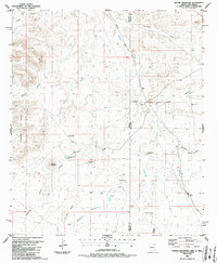
1986 Map of Round Mountain
USGS Topo · Published 1987About this map
Round Mountain and the Bobcat Hills dominate this arid borderlands landscape, where Greenlee County, Arizona meets Hidalgo County, New Mexico. The 1980s terrain is defined by a sophisticated network of small-scale water management features, including Horseshoe Terrace Dam, Stateline Dam, and the series of Dagger Dam No 1, Dagger Dam No 2, and Dagger Dam No 3. These structures catch intermittent runoff from drainages like Coyote Wash and Thompson Draw, essential for sustaining the ranching economy represented by the Lazy B Ranch Landing Strip.
Find a feature on this map
32 named features on this map. Tap any name to fly to it.
Don’t see what you’re looking for? This feature index may not catch every label — zoom into the map to look around manually.
Map Details
Editions of this 1986 Round Mountain Map
This is the sole edition of this map. No revisions or reprints were ever made.
Other maps of this area

1917 · San Simon
USGS Topo · 1:125,000

1926 · Orange Butte
USGS Topo · 1:62,500

1950 · San Simon
USGS Topo · 1:62,500

1951 · San Simon
USGS Topo · 1:62,500

1954 · Silver City
USGS Topo · 1:250,000

1958 · Silver City
USGS Topo · 1:250,000

1959 · Canador Peak
USGS Topo · 1:62,500

1960 · Duncan
USGS Topo · 1:62,500

1962 · Silver City
USGS Topo · 1:250,000
1962 · San Simon
USGS Topo · 1:62,500