1910s Maps of Greenlee County, Arizona
Explore 3 historic maps of Greenlee County from the 1910s. These maps offer a rare glimpse into what life looked like during the 1910s — showing old roads, neighborhoods, homes, and landmarks that have changed or disappeared over time.
Whether you're researching your family's past, planning a metal detecting trip, or studying how Greenlee County's landscape evolved across the 1910s, these high-resolution maps are a powerful tool for exploring the history of this region.
- Focus on a specific era: All maps on this page are from the 1910s, giving you a focused view of this time period.
- See what’s changed: Compare century-old streets, trails, and buildings to today's modern landscape using overlays and satellite layers.
- Research with precision: Use these maps for genealogy, historical research, land use analysis, or educational projects.
- View, download, or print: Maps are fully viewable online in high resolution, and can be downloaded or printed for your own records.
Start exploring Greenlee County's history through authentic maps from the 1910s. This is your window into the past.
Greenlee County, AZ maps
(3)- 1913 Map of Morenci, 1954 Print
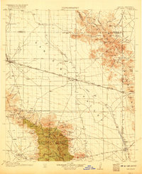
 1913 Morenci1954 Print · USGSArizona's copper country and high timberlands meet in this pre-war survey of the Morenci district and Apache National Forest. Researchers can trace the early industrial footprint of Morenci and Clifton or find family landmarks like Miller Cabin and Cooks Ranch.2 unique versions available
 - 1915 Map of Morenci
 1915 Morenci1915 Print · USGSGreenlee County during the early 1900s shows a landscape defined by industrial copper mining and isolated high-desert ranching. Genealogists and historians can trace family locations from the Eagle Creek School to historic homesteads like Dudley Ranch and the settlement of Oroville.3 unique versions available
 - 1917 Map of San Simon
 1917 San Simon1917 Print · USGSArizona and New Mexico ranching and rail history meet here during the years following the border surveys. Genealogists and historians can locate remote family sites like Posey Ranch, the historical Old Fort Bowie, and early copper or granite works at Willie Rose Mine.3 unique versions available
End of results
Showing maps 1-3 of 3
Top cities of Greenlee County
Frequently asked questions
- What are the different types of historical maps available for Greenlee County?
- What is the oldest map of Greenlee County?
- Where can I purchase historical maps of Greenlee County for my home or office?
- Where can I download high-res historical maps of Greenlee County?
- Are there historical topographic maps available for Greenlee County?
- Is there historical aerial imagery available for Greenlee County?
- Where are historical maps of Greenlee County sourced from?