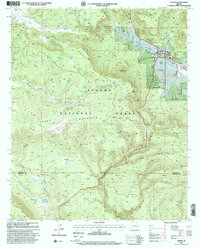
1990s Maps of Greenlee County, Arizona
Explore 41 historic maps of Greenlee County from the 1990s. These maps offer a rare glimpse into what life looked like during the 1990s — showing old roads, neighborhoods, homes, and landmarks that have changed or disappeared over time.
Whether you're researching your family's past, planning a metal detecting trip, or studying how Greenlee County's landscape evolved across the 1990s, these high-resolution maps are a powerful tool for exploring the history of this region.
- Focus on a specific era: All maps on this page are from the 1990s, giving you a focused view of this time period.
- See what’s changed: Compare century-old streets, trails, and buildings to today's modern landscape using overlays and satellite layers.
- Research with precision: Use these maps for genealogy, historical research, land use analysis, or educational projects.
- View, download, or print: Maps are fully viewable online in high resolution, and can be downloaded or printed for your own records.
Start exploring Greenlee County's history through authentic maps from the 1990s. This is your window into the past.
Greenlee County, AZ maps
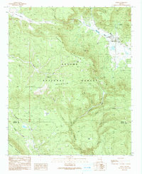
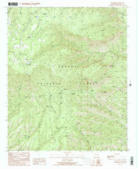
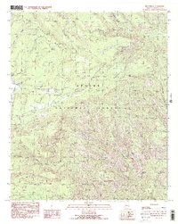
(41)- 1991 Map of Hannagan Meadow
 1991 Hannagan Meadow1991 Print · USGSHigh-country meadows and Forest Service outposts define this corner of the White Mountains during the early nineties. Researchers can trace historic mountain routes and water sources like Hannagan Meadow, the Caldwell FS Station, and the remote Balke Cabin.2 unique versions available
 - 1991 Map of Baldy Bill Point
 1991 Baldy Bill Point1991 Print · USGSGreenlee County's high wilderness terrain is captured here in the early 1990s, revealing a landscape of steep canyons and forest lookouts. Researchers can trace remote landmarks like Saunders Cabin, the cascading Chitty Falls, and the high peak at Baldy Bill Point.
 - 1991 Map of Blue
 1991 Blue1991 Print · USGSThe Arizona-New Mexico state line comes alive in the 1990s as it cuts through the high canyons of the Apache National Forest. Genealogists and researchers can trace local family markers at Jones Cemetery or navigate the remote terrain near WS Mountain and Devils Monument.
 - 1991 Map of Alpine
 1991 Alpine1991 Print · USGSAlpine and the surrounding high country are captured in this late-century survey, showcasing the remote mountain settlement and its ties to the Apache National Forest. Researchers can trace old family landmarks and civic sites like Campbell Flat, the Rodeo Ground, and Milk Ranch Spring.
 - 1991 Map of Luna Lake
 1991 Luna Lake1991 Print · USGSThe high-country borderlands of the Arizona and New Mexico line are documented here in the early 1990s. Local historians can trace the headwaters of the San Francisco River near Luna Lake and locate the small Cem and Double J Ranch.
 - 1991 Map of Strayhorse
 1991 Strayhorse1991 Print · USGSThe high-country wilderness of the Apache National Forest is captured here in the early 1990s, highlighting a landscape shaped by water and timber. Trace the development of backcountry sites like the Strayhorse Forest Service Station, Hagen Corral, and Acre Lake.2 unique versions available
 - 1991 Map of Buffalo Crossing
 1991 Buffalo Crossing1991 Print · USGSIn the high-altitude woodlands of Eastern Arizona in the late eighties, the forest service managed a complex system of camps and river crossings. Genealogists and historians can trace the locations of Brentwood (Site), the Buffalo Crossing Footbridge, and the Clabber City settlement.
 - 1991 Map of Beaverhead
 1991 Beaverhead1991 Print · USGSEastern Arizona high country is mapped here in the early nineties, showing a landscape defined by the drainage of Beaver Creek and Foote Creek. Trace backcountry routes through Apache National Forest to find Cleveland Spring, Castle Rock, and the Devils Washboard.2 unique versions available
 - 1991 Map of Maness Peak
 1991 Maness Peak1991 Print · USGSThe high Arizona-New Mexico border country comes to life in this early 1990s record of the Blue River valley. Local historians can trace family ranching footprints at Luce Ranch or Lazy YJ Ranch and locate community landmarks like the Blue School and Blue Cemetery.
 - 1991 Map of Hoodoo Knoll
 1991 Hoodoo Knoll1991 Print · USGSEastern Arizona’s high country in the early nineties is defined here by the winding Black River and the high peaks of the Bear Wallow Wilderness. Researchers can trace remote routes like the Wallow Pack Trail and locate family-named landmarks such as McKibbins Pond.
 - 1991 Map of Bear Mountain
 1991 Bear Mountain1991 Print · USGSGreenlee County, Arizona, is shown in the early nineties as a remote landscape of high mesas and canyon bottoms. Researchers can trace historic river access at Balke Crossing, locate the Les Ranch settlement, and identify fire-watch landmarks like the Lookout Tower.2 unique versions available
 - 1994 Map of Willcox
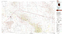 1994 Willcox1994 Print · USGSSoutheast Arizona in the mid-nineties shows a landscape defined by expansive desert basins and rugged sky islands. Genealogists and historians can trace the rail corridor of the Southern Pacific through Willcox, Bowie, and the Kansas Settlement.2 unique versions available
 - 1994 Map of Safford
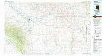 1994 Safford1994 Print · USGSSoutheastern Arizona and the New Mexico borderlands come into focus in the mid-1990s, highlighting the irrigation-fed life of the Gila Valley. Genealogists and researchers can trace local landmarks like Eastern Arizona College, the Southern Pacific RR, and settlements from Artesia to Virden.2 unique versions available
 - 1997 Map of Rose Peak, 2000 Print
 1997 Rose Peak2000 Print · USGSThe high backcountry of Greenlee County comes alive in this late-nineties survey of the Apache National Forest. Genealogists and historians can trace old ranching life through sites like Mallet Ranch, Fulleman Cabin, and various stock corrals along the Coronado Trail.
 - 1997 Map of Bee Canyon, 2000 Print
 1997 Bee Canyon2000 Print · USGSCattle ranching in the Arizona high desert is frozen in time during the late nineties, showcasing the rugged intersection of Greenlee and Graham counties. Genealogists and historians can locate the Double Circle Ranch, the Eagle Creek School, and family-named sites like Hicks Tank.
 - 1997 Map of Hoodoo Knoll, 2000 Print
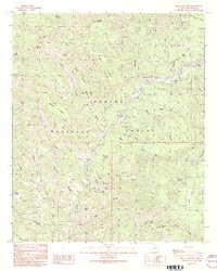
 1997 Hoodoo Knoll2000 Print · USGSGreenlee County high country is mapped here in the late nineties as it transitions from national forest to tribal reservation lands. Researchers can trace remote water sources and landmarks like McKibbins Pond, the Bear Wallow Wilderness, and Soldier Spring.
 - 1997 Map of Maple Peak, 2000 Print
 1997 Maple Peak2000 Print · USGSThe Arizona and New Mexico borderlands come alive in the late nineties, where high-desert ranching life is etched into the canyons and mesas. Researchers can locate the Coalson Ranch, a lonely Grave, and numerous historic water features like Kelly Well Spring and Smoothing Iron Tank.
 - 1997 Map of Alpine, 2000 Print
 1997 Alpine2000 Print · USGSThe high-country community of Alpine thrived as a forestry and ranching hub in the late nineties. Local researchers can trace the development of the settlement through the Alpine Ranger Station, family-held lands like Noble Ranch, and the waters of Judd Lake.
 - 1997 Map of Hannagan Meadow, 2000 Print
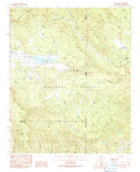
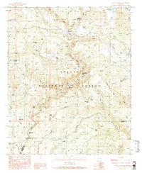
 1997 Hannagan Meadow2000 Print · USGSThe high meadows and forest camps of the Arizona high country appear here in the late nineties, centered on the Coronado Trail. Researchers can trace old forest service outposts like Caldwell FS Station and the remote Balke Cabin or locate livestock landmarks like Willow Corral.
 - 1997 Map of Rattlesnake Spring, 2000 Print
 1997 Rattlesnake Spring2000 Print · USGSGreenlee County high country is documented here in the late 1990s, showing the intersection of National Forest wilderness and small rural developments. Trace livestock history and mountain travel through remote landmarks like Rattlesnake Gap Cabin, Verdee Lee Acres, and Sunset Peak.
 - 1997 Map of Copperplate Gulch, 2000 Print
 1997 Copperplate Gulch2000 Print · USGSGreenlee and Graham counties appear here at the end of the millennium, defined by industrial mining and federal lands. Researchers can trace the massive Morenci Pit (Open Pit Mine) and remote sites like Trujillo or the Coronado Mine.
 - 1997 Map of Blue, 2000 Print
 1997 Blue2000 Print · USGSThe high wilderness of the Blue Range in the late nineties is captured here, straddling the Arizona and New Mexico border. Genealogists and historians can locate the Jones Cemetery and early homesteading sites like Marks Ranch or the cabins at Campbell Flat.
 - 1997 Map of Fritz Canyon, 2000 Print
 1997 Fritz Canyon2000 Print · USGSRemote ranching outposts and stock-raising camps along the Blue River are mapped here in the late 1990s. Genealogists and local historians can trace family-named sites like Stacy Ranch, the Horse Canyon Cabin, and the Joe Fritz Corral.
 - 1997 Map of Robinson Mesa, 2000 Print
 1997 Robinson Mesa2000 Print · USGSEastern Arizona ranching country comes alive in the late nineties, where the high-elevation forest meets tribal lands. Genealogists and historians can trace the footprints of Honeymoon Ranch and 7 Cross A Ranch alongside the historic Coronado Trail.
 - 1997 Map of Baldy Bill Point, 2000 Print
 1997 Baldy Bill Point2000 Print · USGSThe high country of Greenlee County is captured here in the late nineties, where the Bear Wallow Wilderness meets the San Carlos Indian Reservation. Researchers can trace remote landmarks like Saulsbers Cabin, the Lookout Tower, and numerous named water sources like Chitty Falls.
Showing maps 1-25 of 41
Top cities of Greenlee County
Frequently asked questions
- What are the different types of historical maps available for Greenlee County?
- What is the oldest map of Greenlee County?
- Where can I purchase historical maps of Greenlee County for my home or office?
- Where can I download high-res historical maps of Greenlee County?
- Are there historical topographic maps available for Greenlee County?
- Is there historical aerial imagery available for Greenlee County?
- Where are historical maps of Greenlee County sourced from?