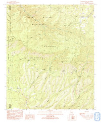
1991 Map of Baldy Bill Point
USGS Topo · Published 1991About this map
Bear Wallow Wilderness and the surrounding reaches of the Apache National Forest define this landscape along the high ridges of eastern Arizona. The terrain is marked by a complex system of drainage and named canyons, including Maverick Spring Canyon, Squirrel Canyon, and McBride Canyon, which feed into major watercourses like Bear Wallow Creek. Human presence is sparse, indicated by the isolated Saunders Cabin and a network of primitive transportation routes consisting of Pack Trails and 4wd tracks that navigate the steep topography.
Find a feature on this map
38 named features on this map. Tap any name to fly to it.
Don’t see what you’re looking for? This feature index may not catch every label — zoom into the map to look around manually.
Map Details
Editions of this 1991 Baldy Bill Point Map
This is the sole edition of this map. No revisions or reprints were ever made.
Other maps of this area

1913 · Morenci
USGS Topo · 1:125,000

1915 · Morenci
USGS Topo · 1:125,000

1922 · Nutrioso
USGS Topo · 1:125,000

1954 · Clifton
USGS Topo · 1:250,000

1957 · Clifton
USGS Topo · 1:250,000

1958 · Clifton
USGS Topo · 1:250,000

1958 · Hannagan Meadow
USGS Topo · 1:62,500

1962 · Clifton
USGS Topo · 1:250,000

1967 · Freezeout Mountain
USGS Topo · 1:24,000

1967 · Robinson Mesa
USGS Topo · 1:24,000