1967 Map of Robinson Mesa
USGS Topo · Published 1970About this map
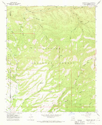
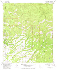
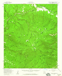
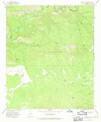
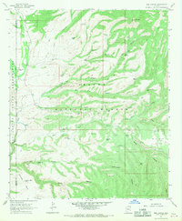
Robinson Mesa rises at the heart of this late-1960s landscape, marking the boundary where the Apache National Forest meets the eastern edge of the San Carlos Indian Reservation. The terrain is defined by a dense network of drainage systems, including Eagle Creek and its many tributaries such as Middle Prong Creek and Wet Prong Creek. Human presence is sparse, centered on isolated ranching outposts like Four Drag Ranch and Cross A Ranch, alongside the seasonal Honeymoon Campground.
Find a feature on this map
33 named features on this map. Tap any name to fly to it.
Don’t see what you’re looking for? This feature index may not catch every label — zoom into the map to look around manually.
Map Details
Editions of this 1967 Robinson Mesa Map
3 editions found

Other maps of this area

1913 · Morenci
USGS Topo · 1:125,000

1915 · Morenci
USGS Topo · 1:125,000

1922 · Nutrioso
USGS Topo · 1:125,000

1954 · Clifton
USGS Topo · 1:250,000

1957 · Clifton
USGS Topo · 1:250,000

1958 · Clifton
USGS Topo · 1:250,000
1958 · Hannagan Meadow
USGS Topo · 1:62,500

1962 · Clifton
USGS Topo · 1:250,000
1967 · Freezeout Mountain
USGS Topo · 1:24,000
1967 · Bee Canyon
USGS Topo · 1:24,000