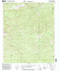
1997 Map of Rose Peak
USGS Topo · Published 2000About this map
The Coronado Trail winds through this high-altitude landscape within the Apache National Forest, providing a vital corridor through a region defined by steep canyons and prominent summits. At the heart of the terrain is Rose Peak, standing alongside other high points like Brigham Peak and Red Mountain. The map illustrates a landscape managed for both recreation and ranching, evidenced by the numerous water improvements such as Engineer Spring, Tincup Spring, and Divide Tanks. Cattle operations are marked by dispersed facilities including the M J Bar Corral, Skunk Corral, and El Paso Corral. To the east, the Blue Range Primitive Area preserves a more secluded environment. Local history is anchored by working sites like the A D Bar Ranch, Mallet Ranch, and the Fulleman Cabin, while the Strayhorse Divide serves as a major topographical spine for the drainage systems of Strayhorse Creek and Rousensock Creek.
Find a feature on this map
63 named features on this map. Tap any name to fly to it.
Don’t see what you’re looking for? This feature index may not catch every label — zoom into the map to look around manually.
Map Details
Editions of this 1997 Rose Peak Map
This is the sole edition of this map. No revisions or reprints were ever made.
Other maps of this area

1913 · Morenci
USGS Topo · 1:125,000

1915 · Morenci
USGS Topo · 1:125,000

1922 · Nutrioso
USGS Topo · 1:125,000

1954 · Clifton
USGS Topo · 1:250,000

1957 · Clifton
USGS Topo · 1:250,000

1958 · Clifton
USGS Topo · 1:250,000

1958 · Hannagan Meadow
USGS Topo · 1:62,500

1961 · Blue
USGS Topo · 1:62,500

1962 · Clifton
USGS Topo · 1:250,000

1967 · Robinson Mesa
USGS Topo · 1:24,000