1960s Maps of Greenlee County, Arizona
Explore 16 historic maps of Greenlee County from the 1960s. These maps offer a rare glimpse into what life looked like during the 1960s — showing old roads, neighborhoods, homes, and landmarks that have changed or disappeared over time.
Whether you're researching your family's past, planning a metal detecting trip, or studying how Greenlee County's landscape evolved across the 1960s, these high-resolution maps are a powerful tool for exploring the history of this region.
- Focus on a specific era: All maps on this page are from the 1960s, giving you a focused view of this time period.
- See what’s changed: Compare century-old streets, trails, and buildings to today's modern landscape using overlays and satellite layers.
- Research with precision: Use these maps for genealogy, historical research, land use analysis, or educational projects.
- View, download, or print: Maps are fully viewable online in high resolution, and can be downloaded or printed for your own records.
Start exploring Greenlee County's history through authentic maps from the 1960s. This is your window into the past.
Greenlee County, AZ maps
(16)- 1960 Map of Guthrie, 1961 Print
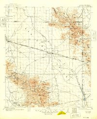
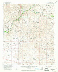 1960 Guthrie1961 Print · USGSGraham County ranching and mining come into sharp focus in the early sixties at the confluence of the Gila River and San Francisco River. Researchers can trace the Southern Pacific rail line to Guthrie and locate remote sites like the Ash Peak Mine and Gillespie Ranch.2 unique versions available
 - 1960 Map of Duncan, 1961 Print
 1960 Duncan1961 Print · USGSThe Gila River valley along the Arizona-New Mexico border is captured here in the early 1960s as a thriving corridor of rail and irrigation. Researchers can trace the Southern Pacific line through Duncan and Franklin, or locate family sites like Cox Ranch and Rainville Ranch.4 unique versions available
 - 1961 Map of Blue, 1963 Print
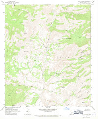
 1961 Blue1963 Print · USGSThe high Mogollon Rim and the Arizona-New Mexico state line meet in the early 1960s, showing a remote mountain landscape. Researchers can trace historic forest outposts and ranch sites like Blue Ranger Sta, Carlton Vista, and the settlement of Blue.2 unique versions available
 - 1962 Map of Silver City
 1962 Silver City1962 Print · USGSThe high desert borderlands of New Mexico and Arizona come alive in this early sixties survey. Genealogists and historians can trace the mining economy through the Chino Mine, follow the rail routes of the Southern Pacific, or locate settlements like Virden and Bayard.
 - 1962 Map of Clifton
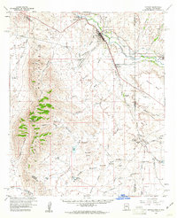
 1962 Clifton1962 Print · USGSThe copper-rich Arizona-New Mexico borderlands come into focus in the early sixties, centered on the mining complexes of Morenci and Clifton. Researchers can trace the Southern Pacific rail lines and locate remote outposts like Honeymoon and the Double Circle Ranch.
 - 1962 Map of Clifton, 1964 Print
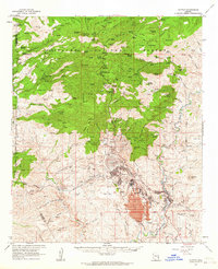 1962 Clifton1964 Print · USGSMining and industry define this corner of Greenlee County in the early sixties, as the copper economy reshaped the Arizona landscape. Genealogists and historians can trace company housing at Plantsite, the massive Morenci Open Pit, and the former town of Metcalf.2 unique versions available
 - 1962 Map of Big Lue Mts, 1964 Print
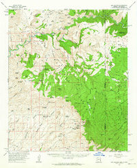 1962 Big Lue Mts1964 Print · USGSThe Arizona and New Mexico borderlands come to life in this early 1960s survey of the high mesas and deep river canyons. Genealogists and researchers can trace isolated homesteads like Martinez Ranch and historic landmarks like the Cliff Dwelling or Black Jack Cave.2 unique versions available
 - 1962 Map of San Simon, 1971 Print
 1962 San Simon1971 Print · USGSThe Arizona-New Mexico borderlands come alive in this survey of the San Simon Valley and the Peloncillo Mountains as they appeared before the Great War. Genealogists and historians can trace the foundations of Old Fort Bowie, the SOUTHERN PACIFIC line, and family landmarks like Riggs Home Ranch.
 - 1967 Map of Alma Mesa, 1970 Print
 1967 Alma Mesa1970 Print · USGSThe Arizona and New Mexico borderlands come into focus in the late sixties, where high mesas meet the deep canyons of the national forests. Researchers can trace remote homesteads and water sources like Charlie Moore Place, Hannah Springs, and the winding Alma Mesa Road.2 unique versions available
 - 1967 Map of Robinson Mesa, 1970 Print
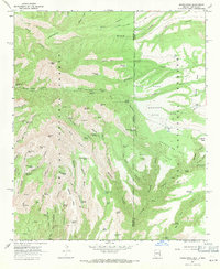
 1967 Robinson Mesa1970 Print · USGSThe Greenlee County high country comes into focus during the late 1960s, showing a landscape of deep canyons and isolated ranching outposts. Researchers can trace historic access routes like the Hogtrail and locate seasonal sites like Honeymoon and Four Drag Ranch.3 unique versions available
 - 1967 Map of Bee Canyon, 1970 Print
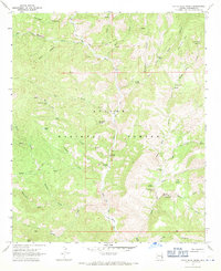
 1967 Bee Canyon1970 Print · USGSRanching and water management define this corner of Greenlee County during the late sixties. Researchers can trace remote cattle operations like Double Circle Ranch and No Bar Ranch, or locate family landmarks like the Cem near Eagle Creek.2 unique versions available
 - 1967 Map of Pipestem Mtn, 1970 Print
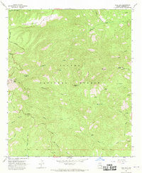
 1967 Pipestem Mtn1970 Print · USGSThe high mesas of Greenlee County are captured here in the late sixties, showing a landscape of forest service land and cattle tanks. Trace old routes like the Coronado Trail or find remote landmarks like Trail Cabin and North Corral.3 unique versions available
 - 1967 Map of Rose Peak, 1970 Print
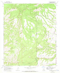
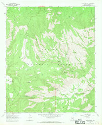
 1967 Rose Peak1970 Print · USGSThe Apache National Forest in the late 1960s reveals a backcountry landscape of high peaks and isolated ranching outposts. Researchers can trace historic routes like the Coronado Trail or locate the Lookout Tower on Rose Peak and the remote A D Bar Ranch.2 unique versions available
 - 1967 Map of Maple Peak, 1971 Print
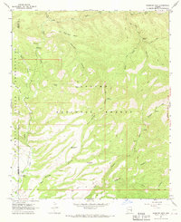
 1967 Maple Peak1971 Print · USGSThe Arizona and New Mexico borderlands come into focus during the late sixties, showing a high-country landscape of national forests and remote ranching outposts. Researchers can trace historic water sources and early trails near Coalson Ranch, Devils Den, and Bullard Peak.3 unique versions available
 - 1967 Map of Dutch Blue Creek, 1971 Print
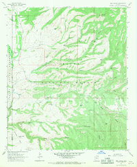
 1967 Dutch Blue Creek1971 Print · USGSGreenlee County ranching and wilderness are captured here in the late sixties as the high country remained a land of trails and isolated cabins. Trace historical outposts like the H U Bar Ranch, find secluded spots like Hannah Hot Spring, and follow the deep Blue River canyons.4 unique versions available
 - 1967 Map of Fritz Canyon, 1971 Print
 1967 Fritz Canyon1971 Print · USGSEastern Arizona ranching and canyon country are captured in the late sixties, showing a landscape shaped by the Blue River. Researchers can locate isolated landmarks like Fritz Ranch, the Grave at Fritz Ranch, and remote watering holes like Wild Bunch Tank.3 unique versions available
End of results
Showing maps 1-16 of 16
Top cities of Greenlee County
Frequently asked questions
- What are the different types of historical maps available for Greenlee County?
- What is the oldest map of Greenlee County?
- Where can I purchase historical maps of Greenlee County for my home or office?
- Where can I download high-res historical maps of Greenlee County?
- Are there historical topographic maps available for Greenlee County?
- Is there historical aerial imagery available for Greenlee County?
- Where are historical maps of Greenlee County sourced from?